|
Copyright John A. Sperr HRIYC.ORG May 1, 2013 Updated Imagery from Downeast Maine
Weather Links
Iceboat Launch Site Maps & Directory for the Eastern
US
|
|
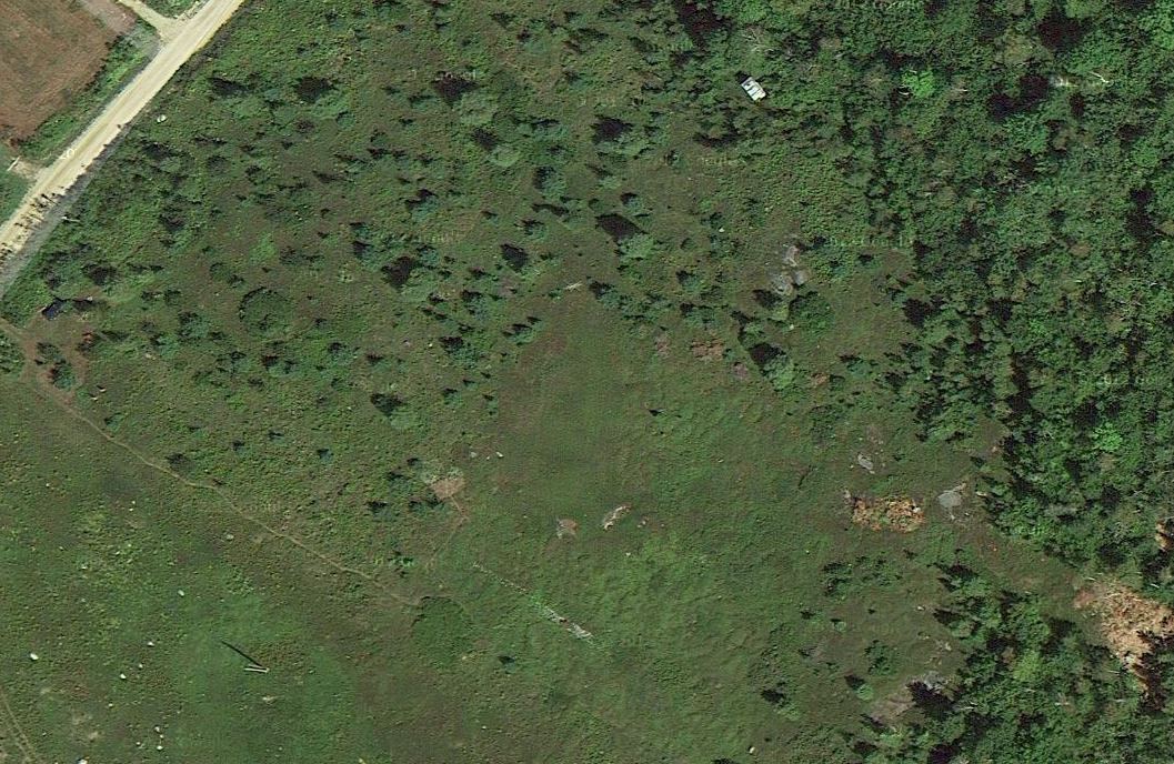
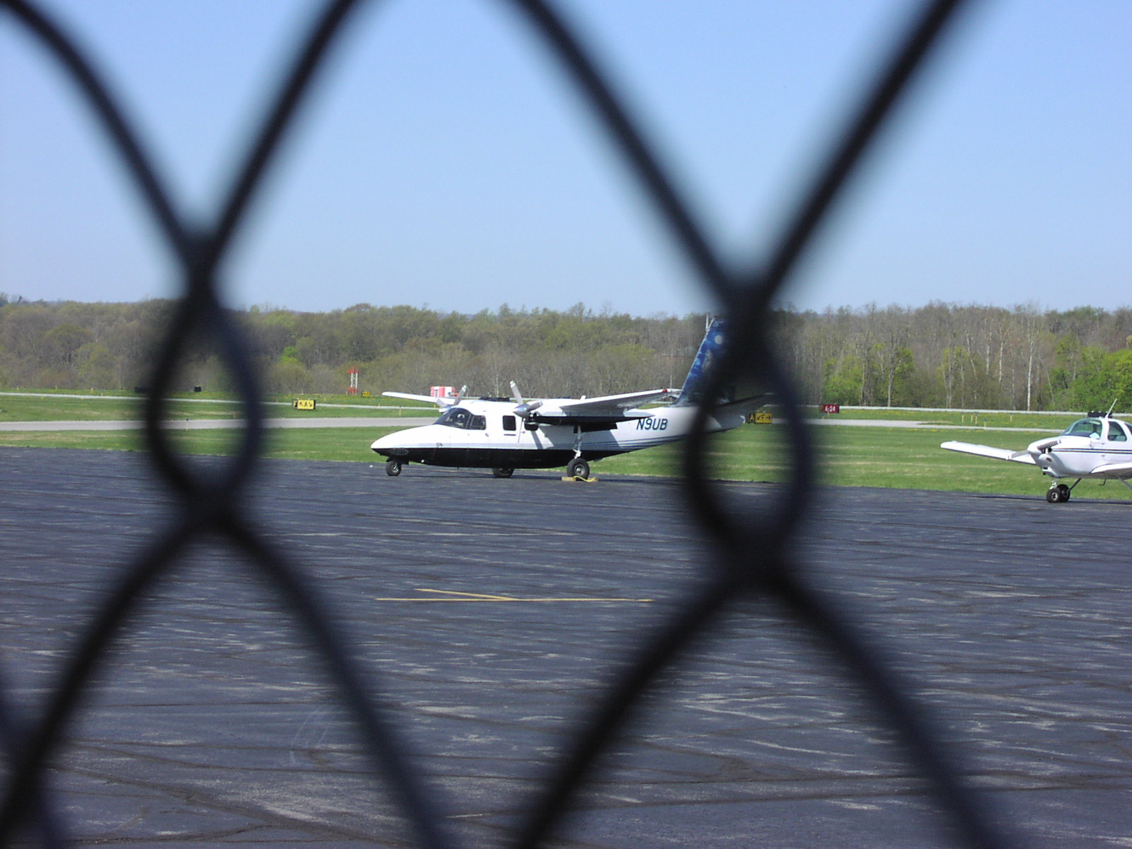
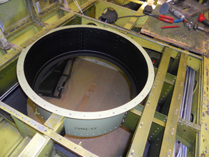
Aerial Imagery Acquisition The common Internet mapping applications, such as the Bing and Google offerings, use a variety of sources for the imagery they produce for display to the end user. Satellites are still effective at capturing large areas where the population is sparse and the need for high resolution is not deemed to be cost effective. In some cases old aerial photographs have been digitized and stitched together to add an historical perspective. In the modern world of GIS, Remote Sensing, and the government's heightened interest in homeland security, aircraft flying below 20,000 feet have become the method of choice for high resolution data acquisition. The imagery above of Downeast Maine was released by Google Maps a few weeks ago and is a major upgrade to what was previously available. As I zoomed in to inspect it, I suddenly realized that I could see what appeared to be my car in the parking area (left middle margin). When I brought the same location up in Google Earth, it's more powerful zoom capability confirmed the date as one when I was there working in our wild blueberry field and convinced me I was indeed looking at my black Passat wagon. Eventually, I was able to locate myself in the image. (If you take up the challenge, let me know where you think you have found me.) The aerial platforms of choice for these photo missions are the Aero Commander twin engined aircraft. Built from 1950 to 1985 with both piston and turbo prop power plants, they are roomy and very stable with their high wing configuration. The can fly fast or slow, and high or low. Camera ports are fabricated in the belly of the plane for a 20 inch diameter piece of inch and a quarter thick optical glass. Control cables, wiring, hydraulic lines, and ducting have to be rerouted during the three month modification. Sanborn Map Company has been flying missions out of Dutchess County Airport this week with a pair of Commanders. Each is equipped with a large format digital camera and LiDAR equipment.
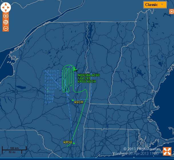
Early spring is the busy time for most of the missions -- GIS municipal data needs to be acquired when there is no snow on the ground and no leaves on the trees. Here's what the flight path looked like for Sunday's mission to Sacandaga Lake and southern Lake George. Parallel passes are flown such that the camera pictures overlap by a specified amount. Software then constructs the oblique views and orthorectifies the images to the correct latitude and longitude.
Recent Photo Albums
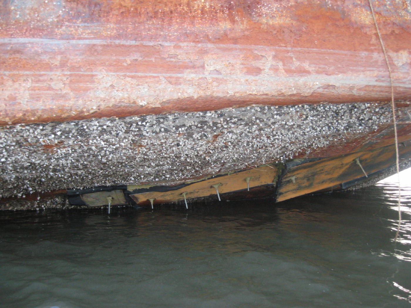
DonJon Marine arrived at the site of the grounded barge at Magdalen Island this week and began salvage operations. Using their clamshell dredge Delaware Bay, they removed the material in the barge, patched the holes with 2" foam board sandwiched between steel plates, and began pumping out the water on Tuesday evening. Dock Shuter sent pictures and reports there has been little visible progress since -- they may be bringing in a heavy lift crane next to remove it from the rocks. A few miles north, divers were busy recovering an old Grumman G44 Widgeon amphibious plane that crashed off Cheviot late last week.
|
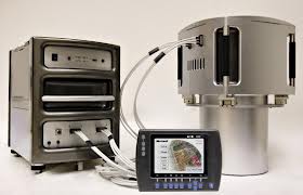
The large format digital UltraCam can capture an 842 megabyte, 260 Megapixel image every 2 seconds in 4 channels of data -- R, G, B and near infrared. Data is stored to rapidly exchanged solid state flash memory disk drives. The control system can be fully integrated with the onboard GPS and aircraft avionics. Light Detection and Ranging (LiDAR) is used to create a three dimensional digital elevation model of ground features. Here the aircraft is operated at a much lower altitude and the time of return of rapid laser pulses reflected from the ground and features below the aircraft are measured and their position recorded. Aerial GPS and Inertial Measurement Units as well as ground based GPS units create an accurate point cloud that can be processed into many useful formats. Buildings, trees, and power lines can be accurately mapped with good detail or very accurate ground contour maps can be rapidly created. LiDAR is finding increased importance as global sea levels rise and planners are beginning to act on the need to protect our current shoreline infrastructure.
Just as you can locate ships by their automated AIS broadcast beacons, all commercial aircraft and private aircraft flying under instrument flight rules (IFR) are required to have an operating transponder that periodically broadcasts identity, heading, speed, and altitude to the air traffic control network. Combined with radar and flight plan data, a fairly accurate picture of the airspace is created in real time. Much of this is available to the public and has been incorporated in several web based plane spotting programs. I've used FlightAware for several years -- it has many good features particularly if you are tracking a commercial flight for delays and diversions, but the data is delayed 5 minutes from the FAA for security reasons and is filtered to eliminate information from people who have requested that their data not be put in the public stream. Transponders operating in ADS-B mode can squitter extended information that other planes operating nearby can use for situational displays and automated collision avoidance warning systems. With the GPS location of the aircraft added to the data stream, it becomes easier for anyone to track and identify the aircraft flying overhead in real-time. For a mere $18, you can purchase a small USB dongle (NooElec R820T RTL SDR) that contains a receiver and a "software defined radio" that you program with a simple download (ADSB#) from the Internet. Hang a short antenna out your window and you can get instant ID and flight information from planes operating in your area. You can display them on your computer using a free program such as adsbScope or USAPhotoMaps or share them with the world on flightradar24 -- a popular program that combines both the real-time data from end users and the traditional delayed public data stream. I had mine up and running in short order -- with the simple antenna included in the kit sitting in my window, I am receiving signals 70 miles to my south and can watch the traffic flowing into the metro NY airspace. A 787 went just a bit too far east to be physically visible on Wednesday afternoon (5/14/2013). |

Links to Field Reports of Ice Conditions
IDNIYRA Ice Conditions Reports
Brakes On? ![]()
photo Copyright Brian Reid,
December 2002

|
HRIYC.ORG is neither the official website, nor am I the webmaster, of the Hudson River Ice Yacht Club. I am a long standing member of the Club and during the sailing season I frequently post photographs and information on this, my own personal website, about current iceboating activity in the Hudson Valley and beyond. I am the sole person responsible for the presentation of content and the opinions expressed herein. Interesting photographic contributions are welcome and appreciated -- I spend most of my time on the ice skippering and far too often fail to capture the best images the day has to offer. ©John A. Sperr MMXIII |