|
Copyright John A. Sperr Preserving and Sailing the Historic Gaff Rigged Ice Yachts of New York's Hudson River Valley HRIYC.ORG Thursday 7 am -- February 19, 2015 Snowed Out -- No Sailing on the River or Tivoli Bay -- A Snowy Winter Continues its Grip Sub-zero cold the rest of this week NSIBYC snowed out -- Sweepstakes Races at Red Bank called off Snow and Rain are in the Weekend Forecast for the Hudson Valley
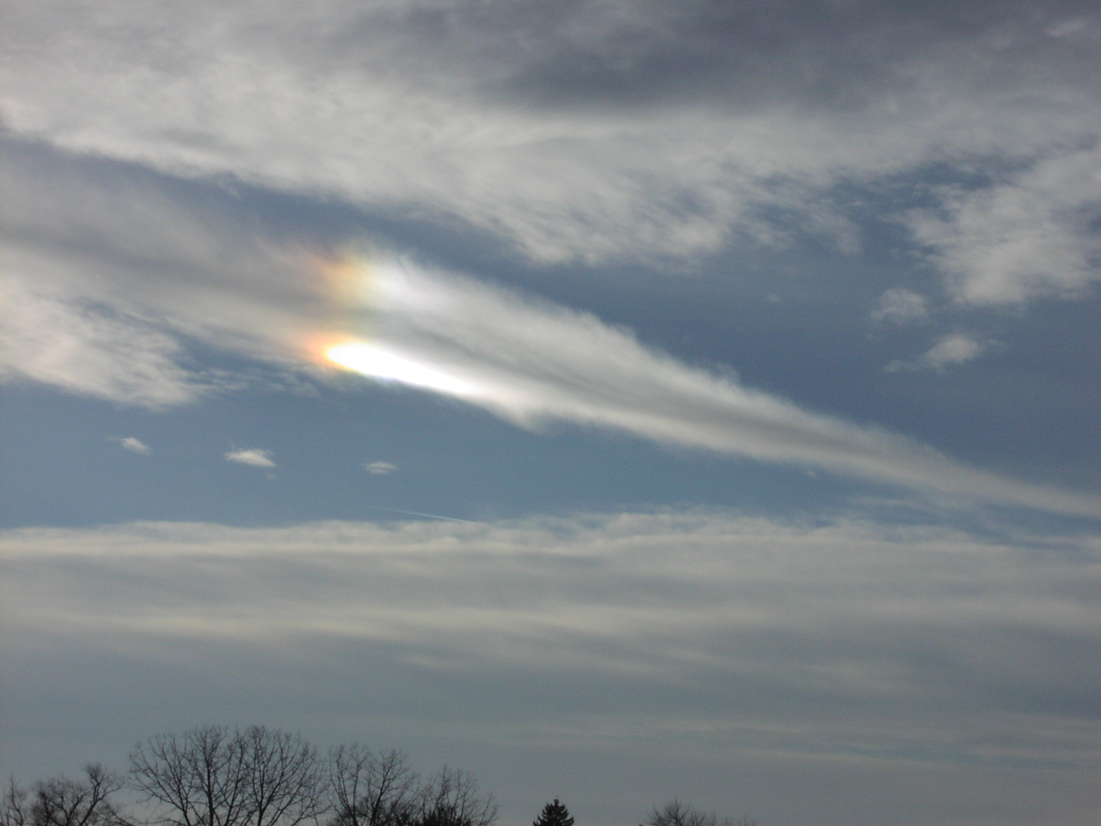
Ice Flight Photos Feb 11, 2015 Ice Flight Photos Jan 21, 2015 Ice Flight Photos Jan 17,
2015
Weather Links Iceboat Launch
Site Maps & Directory for the Eastern US right click and select "view image" to see photos in full resolution |
|
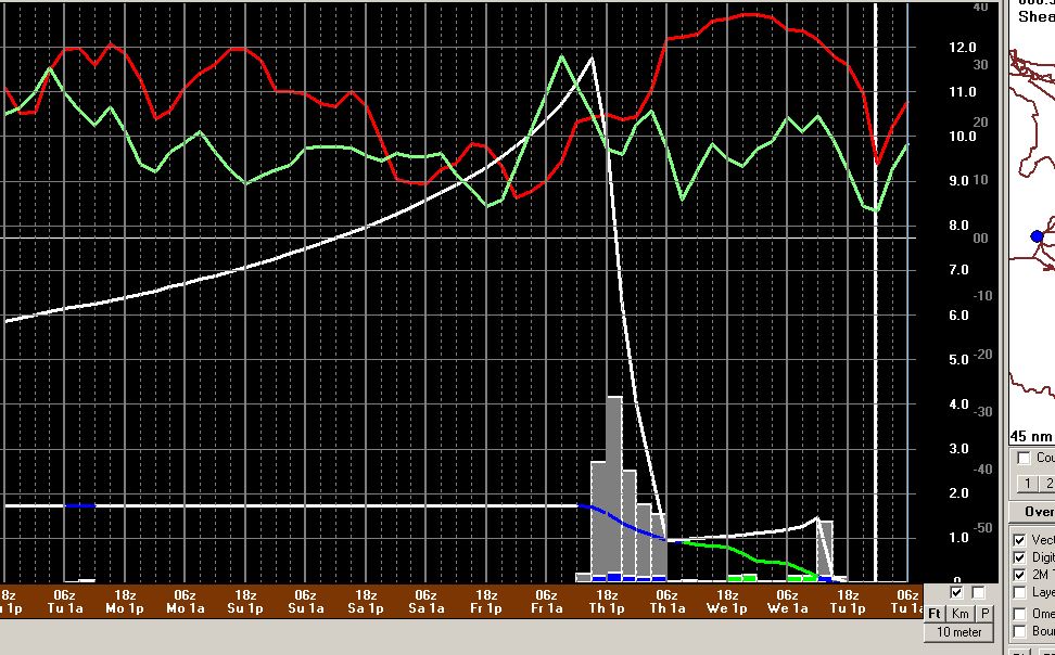
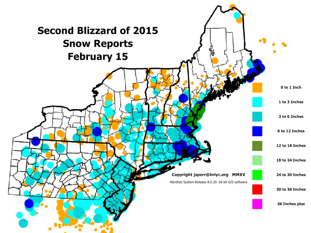
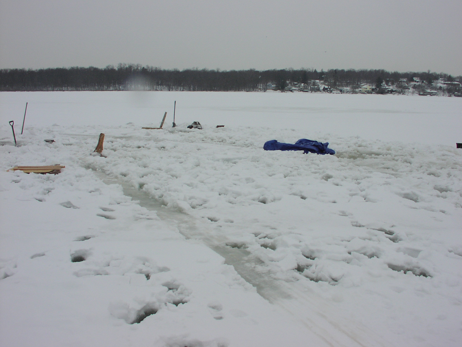
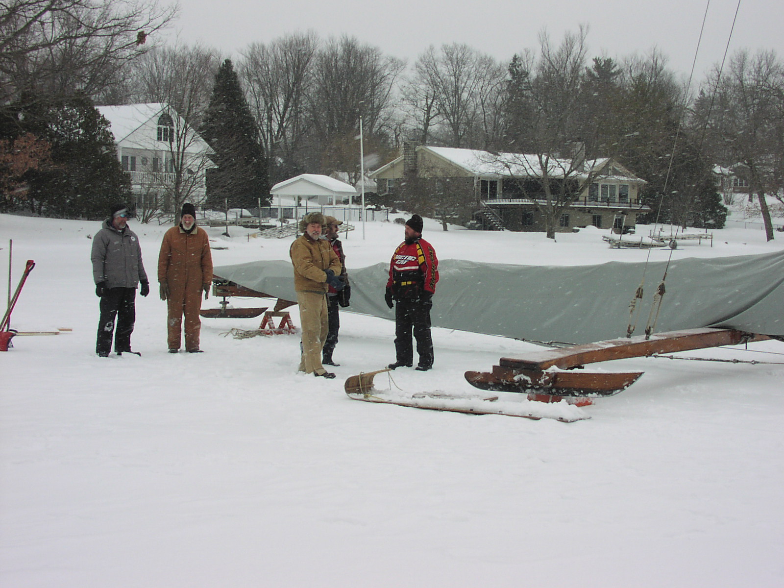
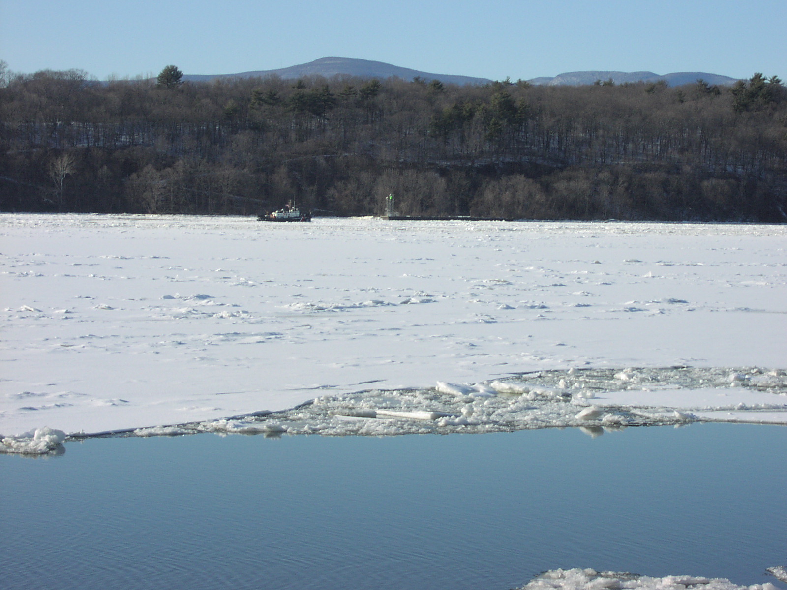
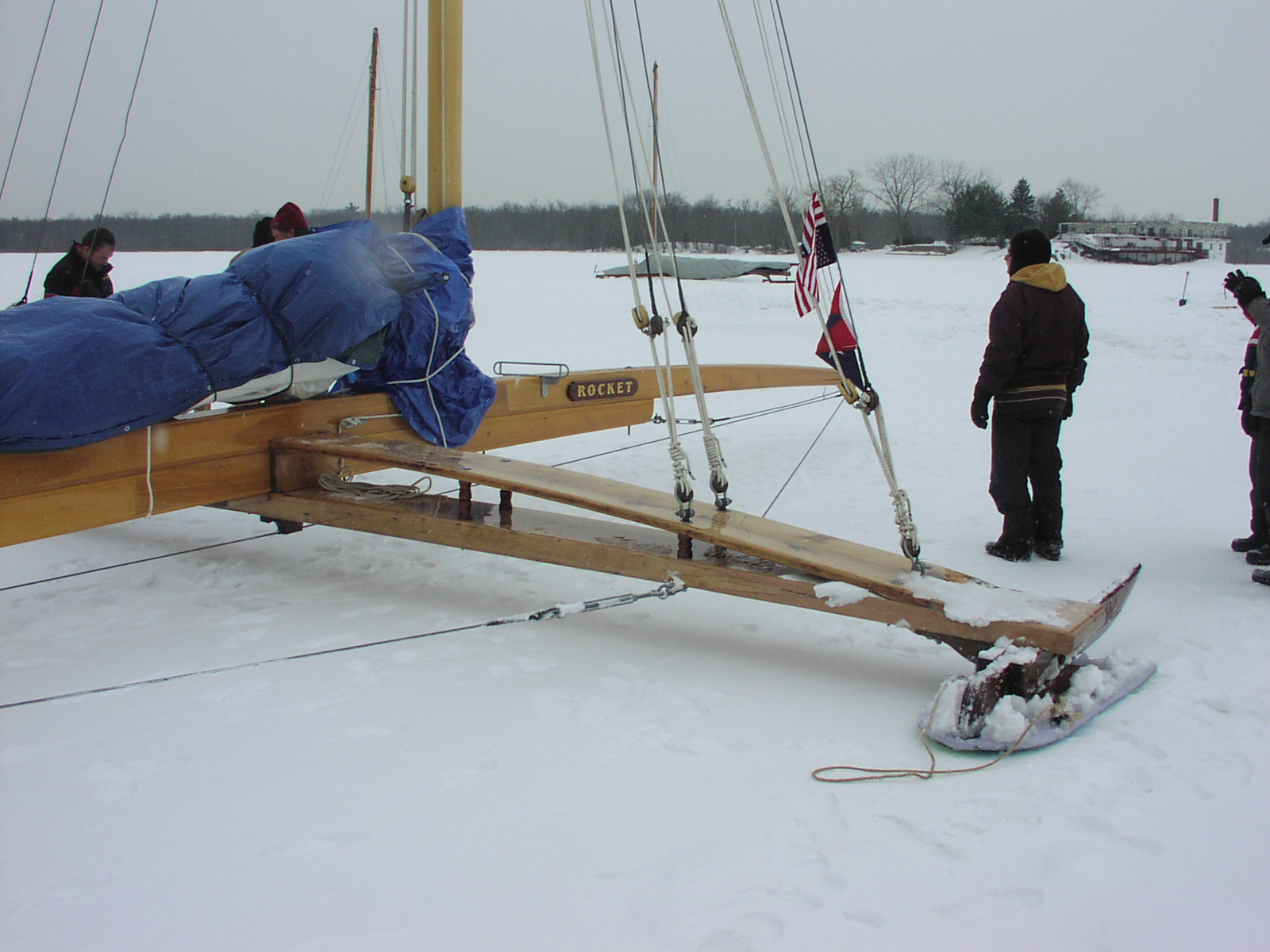
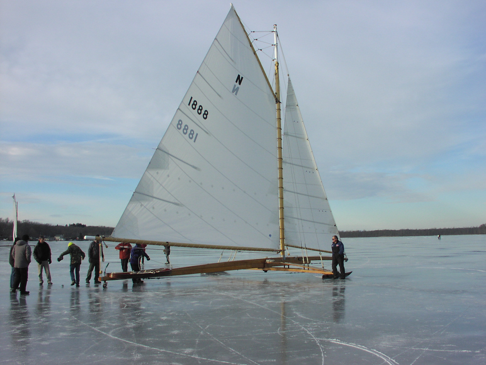
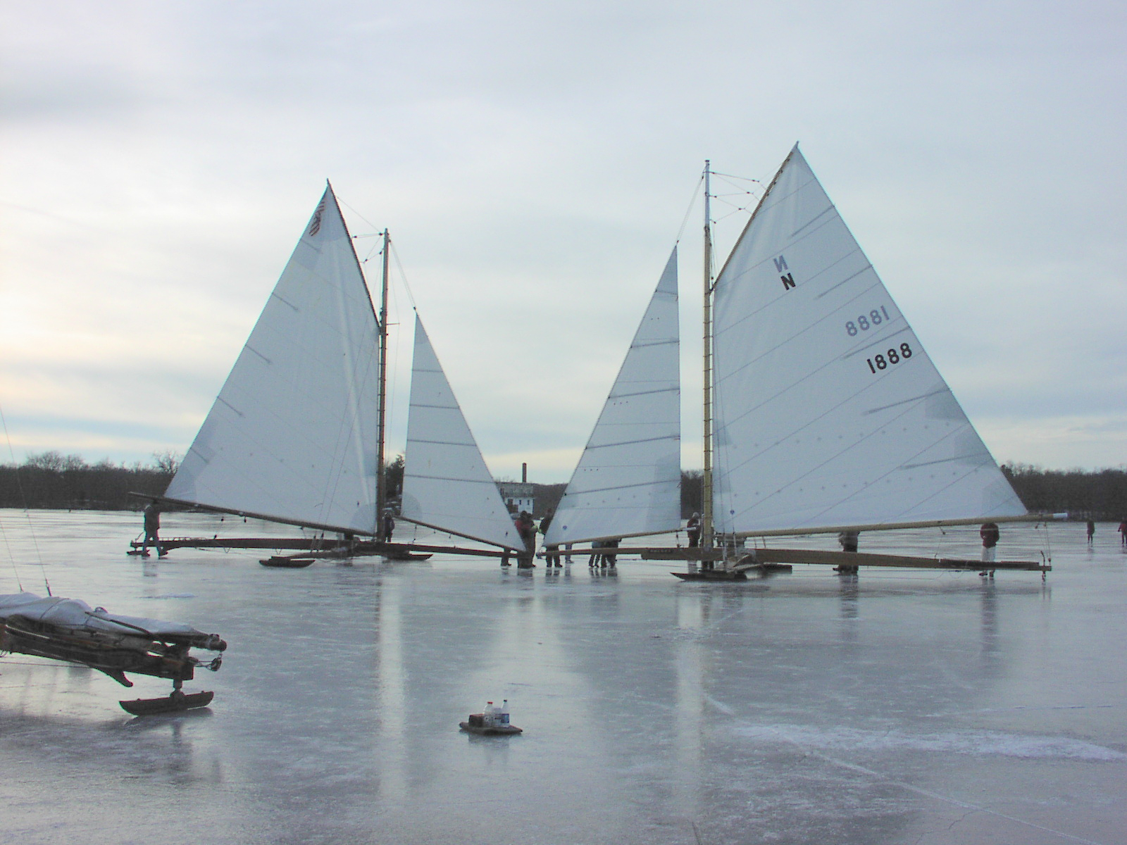
Wednesday, February 18, 2015 update: With more snow and sub-zero arctic temperatures in the forecast for the coming week, it became imperative to dig out and move the big boats Saturday that have been idled almost since they were put on the ice. A crew of 20 assembled, donned in waterproof boots, and shoveled the boats free of a foot of the drifted slushy mess that surrounded them. A path was then cleared to an area closer to shore where the slush was not as deep and had largely frozen in the zero degree early morning chill. ROCKET was the first to be moved -- jacked up at each end of the plank in turn, while a small plastic child's sled and a piece of 1" plywood was placed under the runner. With a mighty shove and a lot of hands hauling on the rope wrapped around the stern post, off we went toward shore. In short order, the sleds lost their positions under the runners and we did the drill all over. Exhausting work, but within an hour we had moved JACK FROST to a safe spot as well, cleared the ice of our tools and were happily celebrating in the warmth of Rick's basement. Thank you to everyone who helped -- it's one of the things I am proudest of in our group -- the ever willingness of everyone to drop whatever they are doing and show up and help when the call goes out. The river has hardened up everywhere after two zero degree days -- it's drifted snow and rough ice in most places -- barges are starting to have trouble as far south as West Point. We'll get out and look at it, but we will probably need some rain or warm weather to smooth it out if we are to get any sailing from it. The models are converging on the weekend forecast -- it looks like a mix of snow and rain is what we can expect. A crusty mess or heavy wet snow could be the result -- and then another storm shows up near the end of the forecast period. I do not foresee any sailing here in the Hudson Valley at this time.
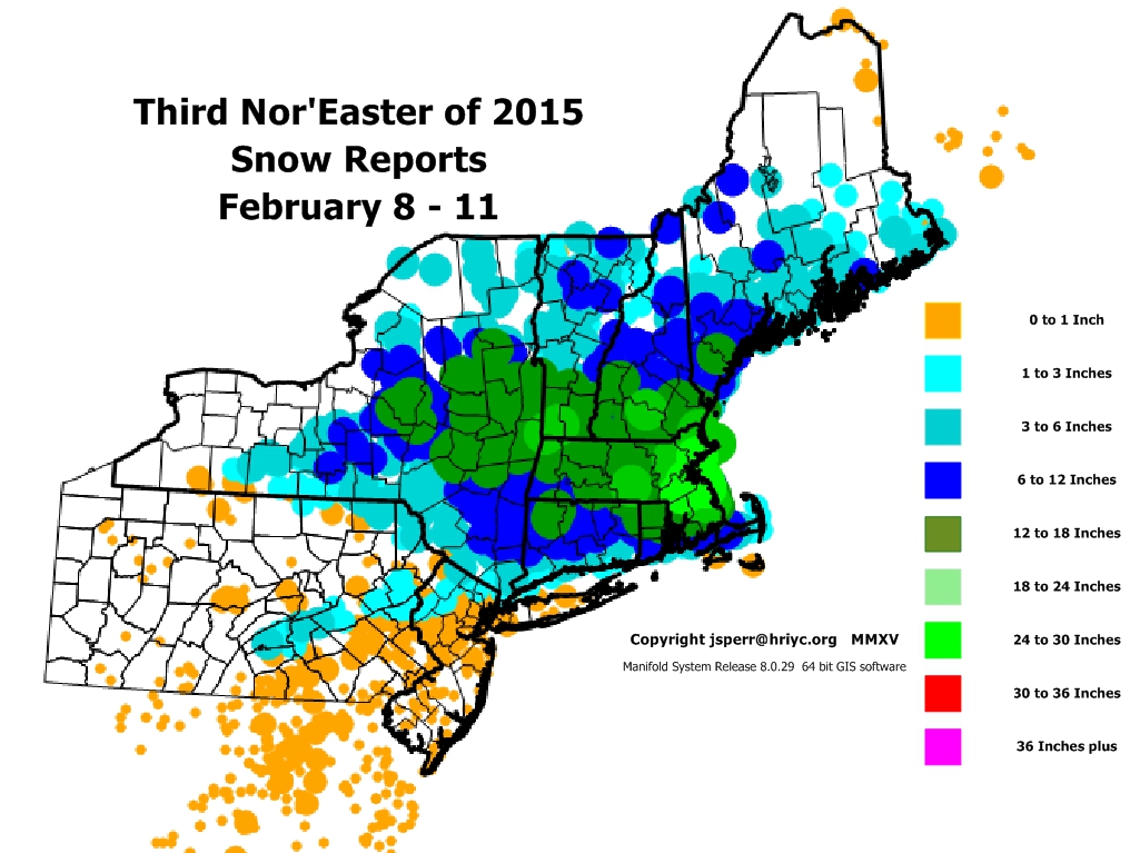
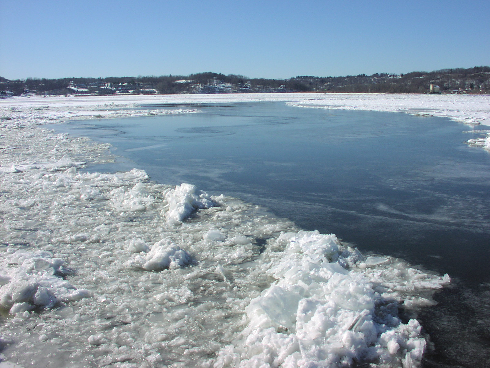
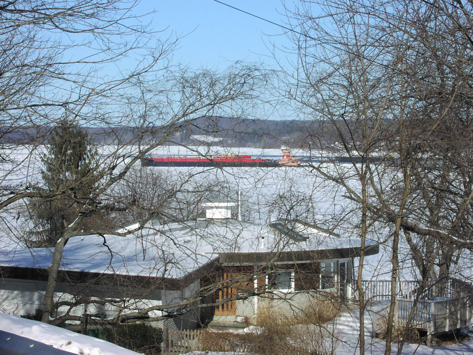
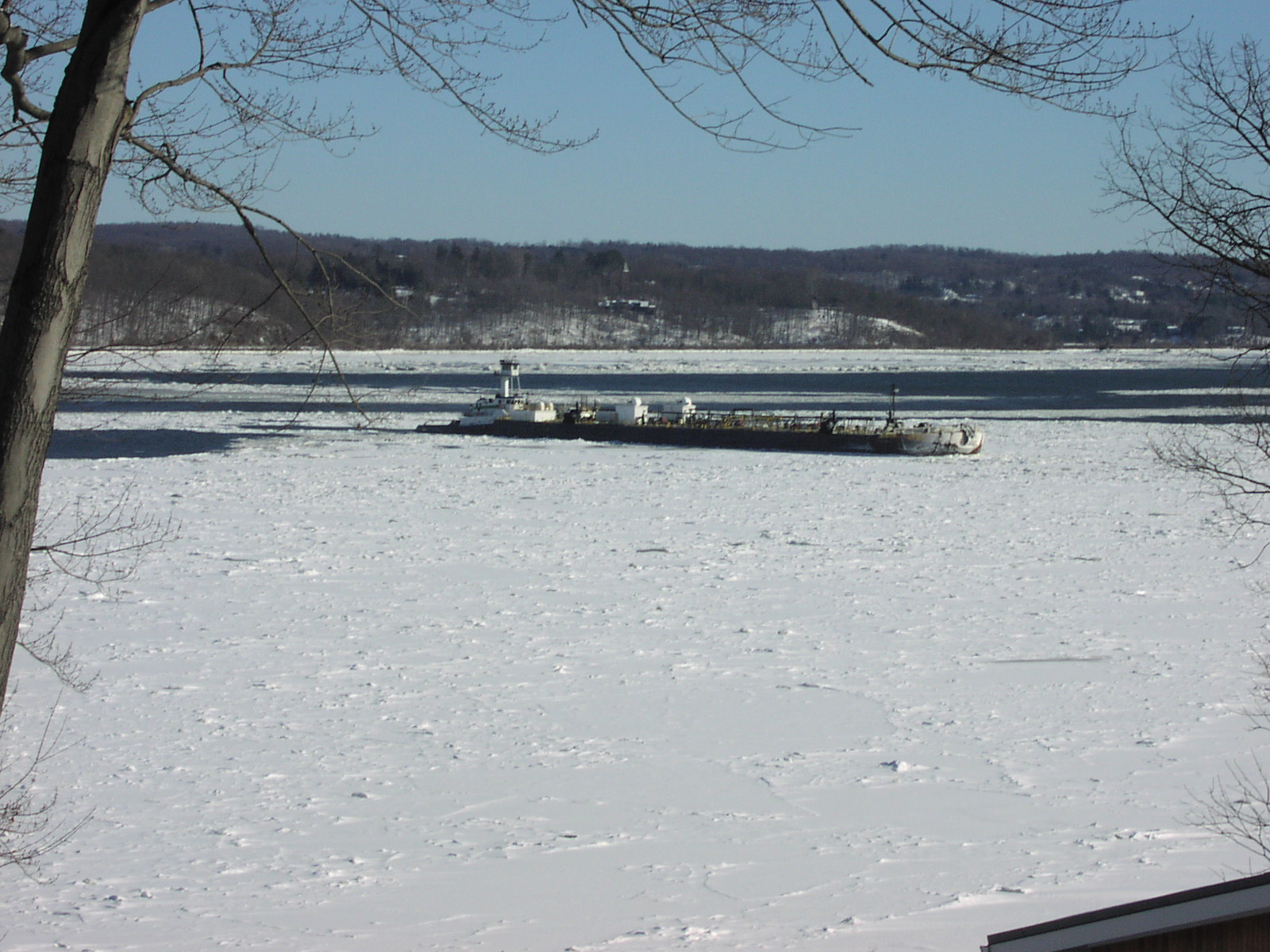
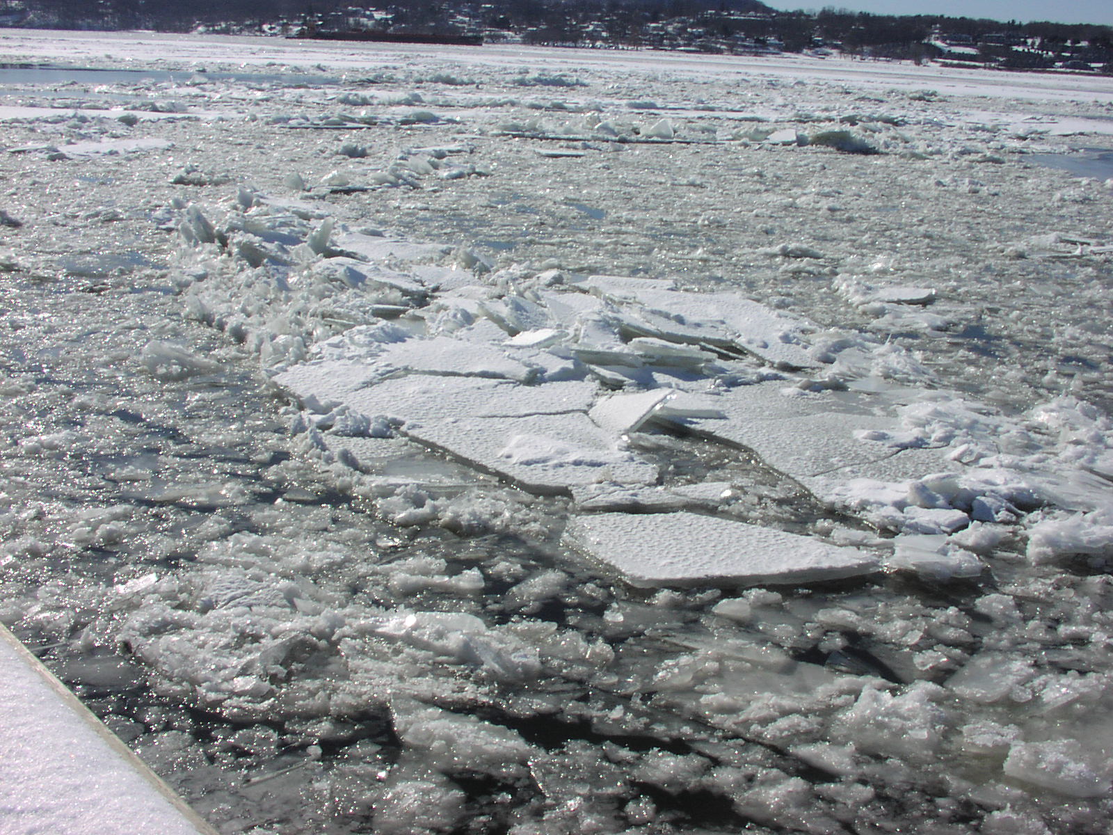
Thursday, February 12, 2015 update: We received another half foot of snow early this week -- while the snow is wetting out nicely at most locations, the base ice is not very thick and there are many large areas of open water. On the Hyde Park / Poughkeepsie border, Bob Wills measured 5 inches of ice topped by 3 inches of slush and 2 - 7 inches of new drifted snow. This should all harden up by Saturday into a rather thin and weak mess that will not be sailable this weekend -- high wind could easily tear it out before the next round of snow arrives Sunday. The ice is loose in some locations and fast in others where there are broad expanses of open water showing. I suspect the large oil tankers exporting the fracking crude out of Albany are having an impact on our winter ice. The Asphalt Star arrived yesterday for loading, and Afrodite will return in a week from its regular shuttle to the Irving refinery in St. Johns, New Brunswick. These big ships displace a lot of water as they move through the channel and the resulting bow wave is amplified as it reaches the shallower waters of the river and stresses any weaknesses in the large expanses of thin ice, setting the large plates of decent ice constantly adrift and further fragmenting them. With sub-zero arctic air on our doorstep and forecast to remain with us on-and-off through next week, many locations may harden up and be fast from Rhinecliff north. There is also more snow in the forecast for next week -- Red Bank, NJ may be the big winner in all of this if they gain another 4 - 6 inches of thickness by Monday -- they have largely escaped the snow to date -- and so, may run the Sweepstakes Races this weekend if conditions are right.
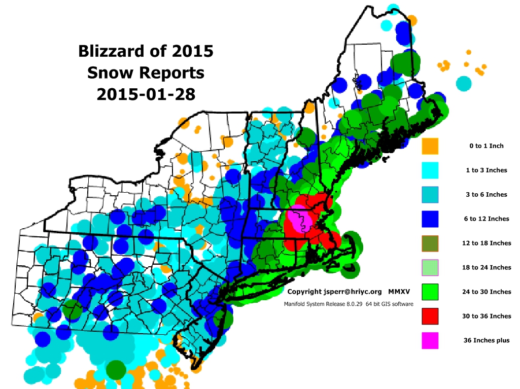
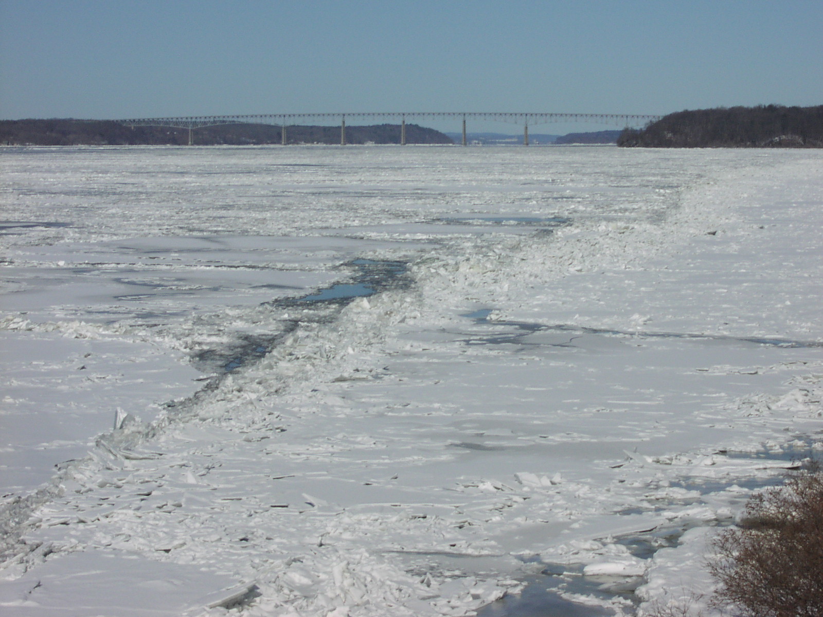
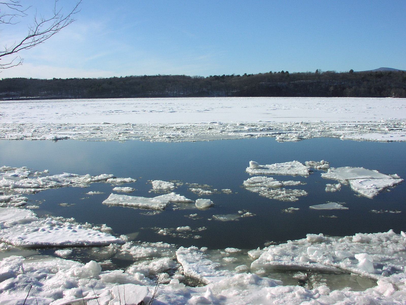
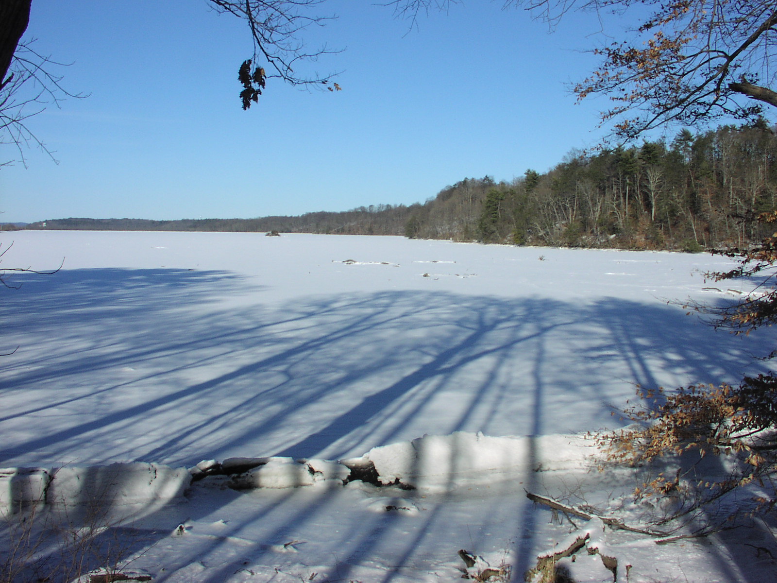
Saturday, February 7, 2015 update: We are snowed out -- you can see this very well in the latest release of aerial photos. The only sailing action is to our south at Red Bank, New Jersey where they will attempt to run the "Icebird World Championships" this Saturday. More light snow will arrive Saturday afternoon and will continue and become heavier Sunday into Monday if the current forecast plays out. We could have another 8 - 12 inches across the Hudson Valley by next Wednesday. Beyond that, it is anyone's guess if we will have any sailing this season or not. Saturday, January 31, 2015 update: It was a snowy week -- I believe we shoveled the driveway at least once every day this past week. While we missed the big blizzard, we did get enough snow to keep us off Tivoli Bay. Sailing throughout the northeast has largely halted -- snow, saturating snow, or drifted snow has shut down most venues. Forecasters are calling for another major snowstorm that will begin late Sunday afternoon and continue through very late Monday afternoon. The precipitation shield is very large with this storm -- the effects will be felt across the entire state. Most of the models are showing a foot of snow for our area in the Hudson Valley -- New England will probably get more, while our friends in Red Bank will likely see a sloppy mix of snow to rain and then back to snow. As the storm departs, the temperature should drop below zero Monday night -- if we had the right mix of high wind blowing the rough ice to the eastern shore, the River might take a good set with a clean sheet of ice -- whether it will hold in and thicken enough to give us some sailing in a week or two remains extremely questionable in my mind. Reid Bielenberg reported that the ice at Athens is thin and rough -- that's no surprise considering the strong current and the occasional warm discharge into the river just south of there from the power plant in Leeds. Cheviot has the best potential at the moment -- a sheet of windblown black ice that has about 6 inches of thickness with some open water along the line of pilings that run out to the old wharf. If Monday's storm arrives with enough wind to clear the ice of the powdery snow that is expected, then the cold air of next week might build enough thickness to make it safe and lock it in for a few weekends of sailing. My feeling is that Cheviot will get a fresh covering of 10 inches of snow which will have to saturate and clean up before we can sail there. The ice on the river has been very dynamic this season -- it may surprise us once again in the coming weeks.
Sunday, January 25, 2015 update: Snow all day yesterday and the threat of an impending nor'easter kept us off the ice this weekend. A strong afternoon had all the ice on the river in full motion this afternoon -- blue water was everywhere north and south of the Rhinecliff Bridge.
The northern branch of the jet stream has finally come into play with a classic dive south across the central US and a return hook up the east coast. The morning news was filled with talk of blizzard warnings and whiteout conditions as a powerful nor'easter takes shape Monday afternoon and carries on throughout the day Tuesday. Forecasters are comparing the potential of the looming storm with the the monster nor'easter of March 13, 1993 that brought 31 inches of snow to Red Hook.
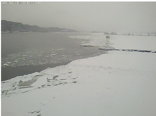
"Snow in January makes Ice in February" is an oft heard saying in the iceboating world. The snow saturates from below and refreezes into "snow ice" -- a softer ice that lacks the strong flat thin hexagonal plate structure of black ice due to air being entrained in the snow and then trapped in the ice during the conversion process. Eventually the sun and rain work the last bit or remaining snow off the surface and we may find a sheet that is smooth enough for sailing and and thick enough for safety. Thursday, January 22, 2015 update: The weather models have been having a difficult time over the past few weeks. I'm not convinced that throwing more petaflops of computer power at the simulation of world wide weather will ever result in a high forecast confidence beyond 72 hours. While the recently upgraded computer cluster that produces the NOAA / NWS forecasts seems to be performing better lately, all the models including the vaunted ECMWF (Euro model) seem to be struggling to define a forecast for this weekend. A zonal flow of warm moist air out of the Gulf of Mexico in the southern jetstream and no strong northern jet pulling down cold air to define the precipitation and flow patterns spatially, seem to be confusing all the computer based solutions this evening. Weather is just too vast and complex to be boxed into a series of equations trying to embrace all the vagaries that exist. South Tivoli Bay has cleaned up nicely with the rain of last Sunday and is ready for action providing we do not get any significant snow with the coastal storm Saturday. All the models seem to be waffling on this storm -- we will probably not have a clue until the storm has come and gone by late Saturday afternoon as to what the outcome will be. There is no sailing on the river at this time -- please do not arrive at Astor Point in anticipation of enjoying a day on the ice such as we had last March -- it is largely open water with a few large floes occasionally bumping up against the shore with the wind and tide -- not a safe or desirable situation for anyone. See the latest series of Ice Photos as linked in the headlines for the complete picture.
Sunday, January 18, 2015 update: It will be a rainy Sunday in the Hudson Valley -- the GFS has held the course with a slight delay in the onset of the freezing rain early this morning. At 9 am, the weather radar imagery showed the area of freezing or mixed precipitation had progressed to Poughkeepsie and Stewart Airport. The NYS Thruway has just been closed south of Newburgh due to freezing rain causing many multiple vehicle accidents. High winds destabilized the sheet of ice below the Rhinecliff Bridge on Friday afternoon. Most of the ice south of the bridge was loose and moving around Saturday morning -- by afternoon, the ice above the bridge was on the move as well with huge expanses of open water showing in front of Astor Point. The tides are approaching their maximum high elevation over the next five days of the current lunar cycle -- this does not bode well for the ice below Saugerties. A good shot of rain will further destabilize the ice at Astor Point, but it will help clean up some of the other areas that were put out of action by two recent light snowfalls. South Tivoli Bay is currently out of action as it is covered with a Styrofoam like coating of snow. From Saugerties to North Germantown, the ice is snow covered with patches of rough ice -- these venues will all benefit from a good grooming of warm air and rain this afternoon.
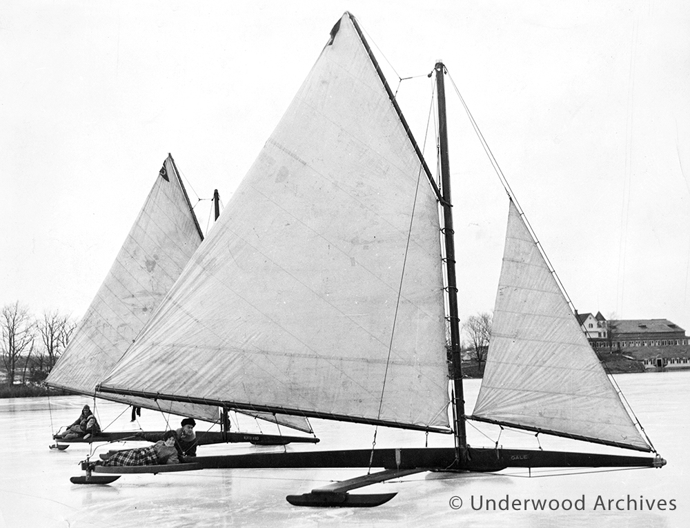
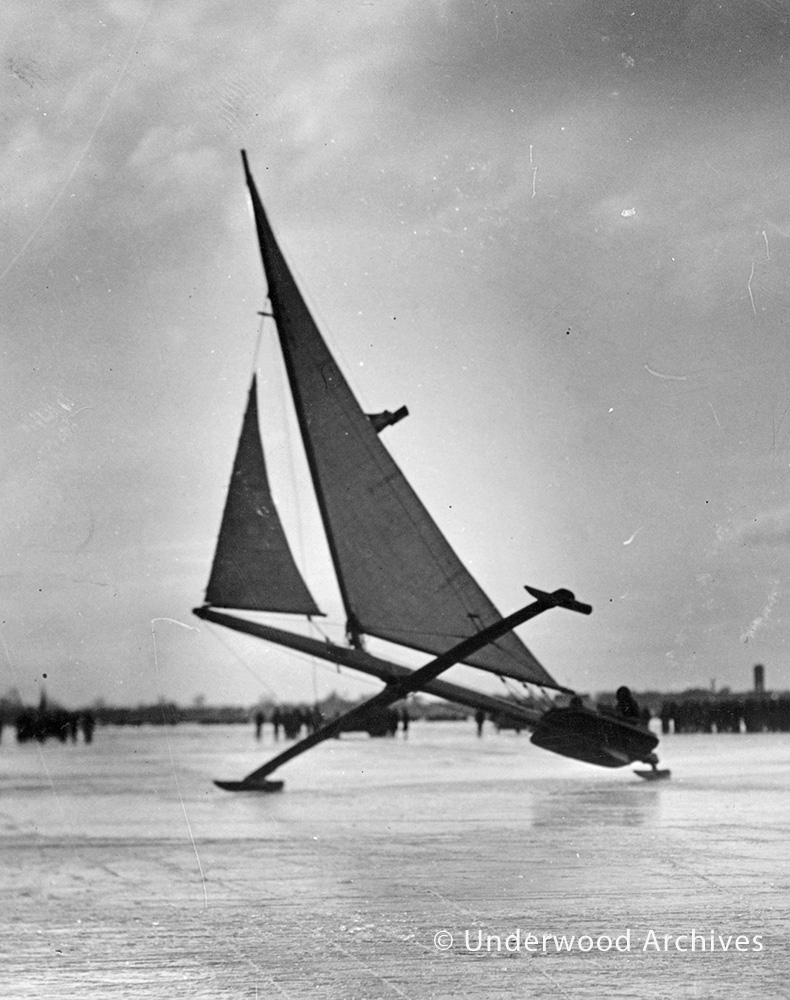
Special thanks to Ray Chipault and Underwood Archives.
Recent Photo Albums
|
Web Page Archives
May 24, 2013 Archive August 1, 2013 Archive April 14, 2013 Archive May 1, 2013 Archive February 20, 2013 Archive March 17, 2013 Archive September 23, 2012 Archive December 22, 2012 Archive June 4, 2012 Archive July 14, 2012 Archive December 26, 2011 Archive December 15, 2011 Archive October 2011 Archive Early Summer 2011 Archive May 2, 2011 Archive March 1, 2011 Archive February 24, 2011 Archive February 19, 2011 Archive
|

Links to Field Reports of Ice Conditions
IDNIYRA Ice Conditions Reports
Iceboat Launch
Site Maps & Directory for the Eastern US
Brakes On? ![]()
photo Copyright
Brian Reid, December 2002
|
|

|
HRIYC.ORG is neither the official website, nor am I the webmaster, of the Hudson River Ice Yacht Club. I am a long standing member of the Club and during the sailing season I frequently post photographs and information on this, my own personal website, about current iceboating activity in the Hudson Valley and beyond. I am the sole person responsible for the presentation of content and the opinions expressed herein. Interesting photographic contributions are welcome and appreciated -- I spend most of my time on the ice skippering and far too often fail to capture the best images of the day. ©John A. Sperr MMXV |