|
Copyright John
A. Sperr
Preserving and Sailing the Historic
Gaff Rigged Ice Yachts of New York's Hudson River Valley
HRIYC.ORG
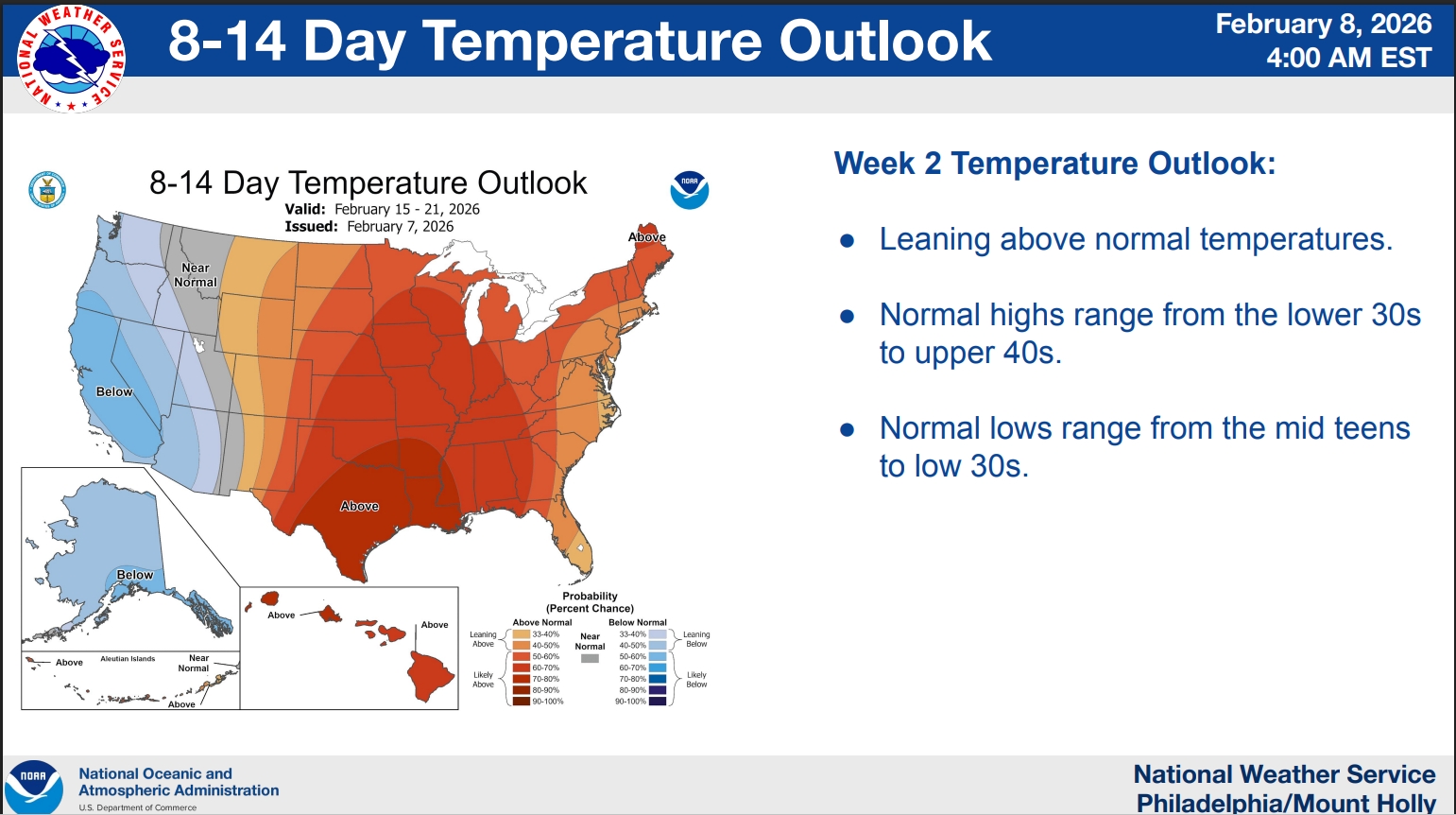
CURRENT CONDITIONS
Monday March 16, 2026
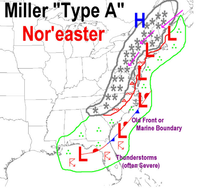
Blizzard Conditions in Chicago --
Thunderstorms possible in the Hudson Valley Tonight
The Season is Over Here -- Windup
Gathering April 11th
Lawrence Farm Orchards
39 COLANDREA ROAD NEWBURGH NY 12550
1:30 - 4:30 pm
Gourmet
Potluck
Bring a dish to share and your favorite beverage
*
There will be ziti, caesar salad & cheesecake. Fill in as
you see fit!
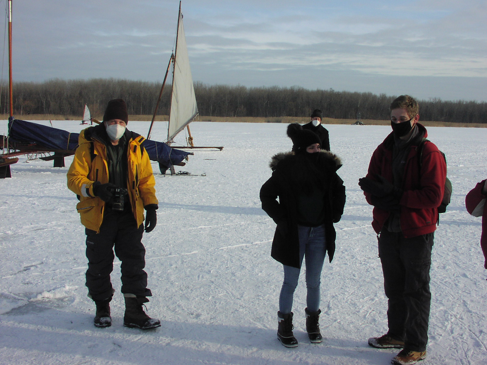
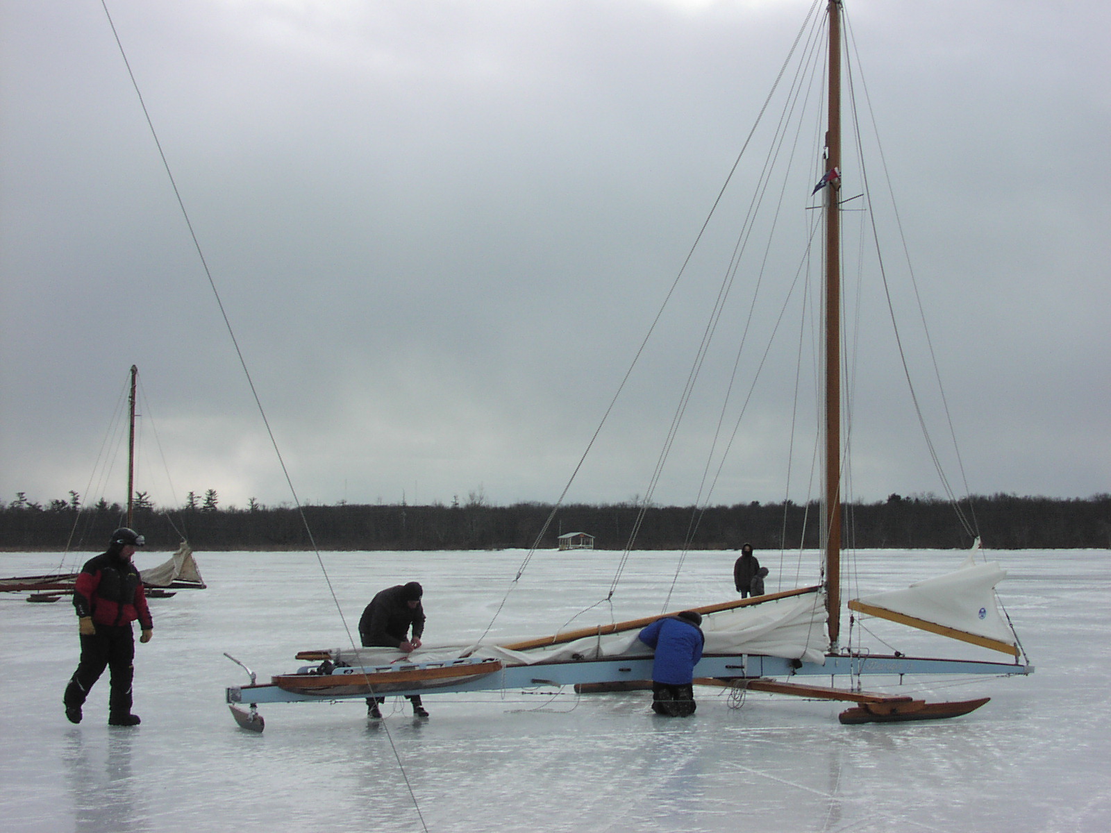
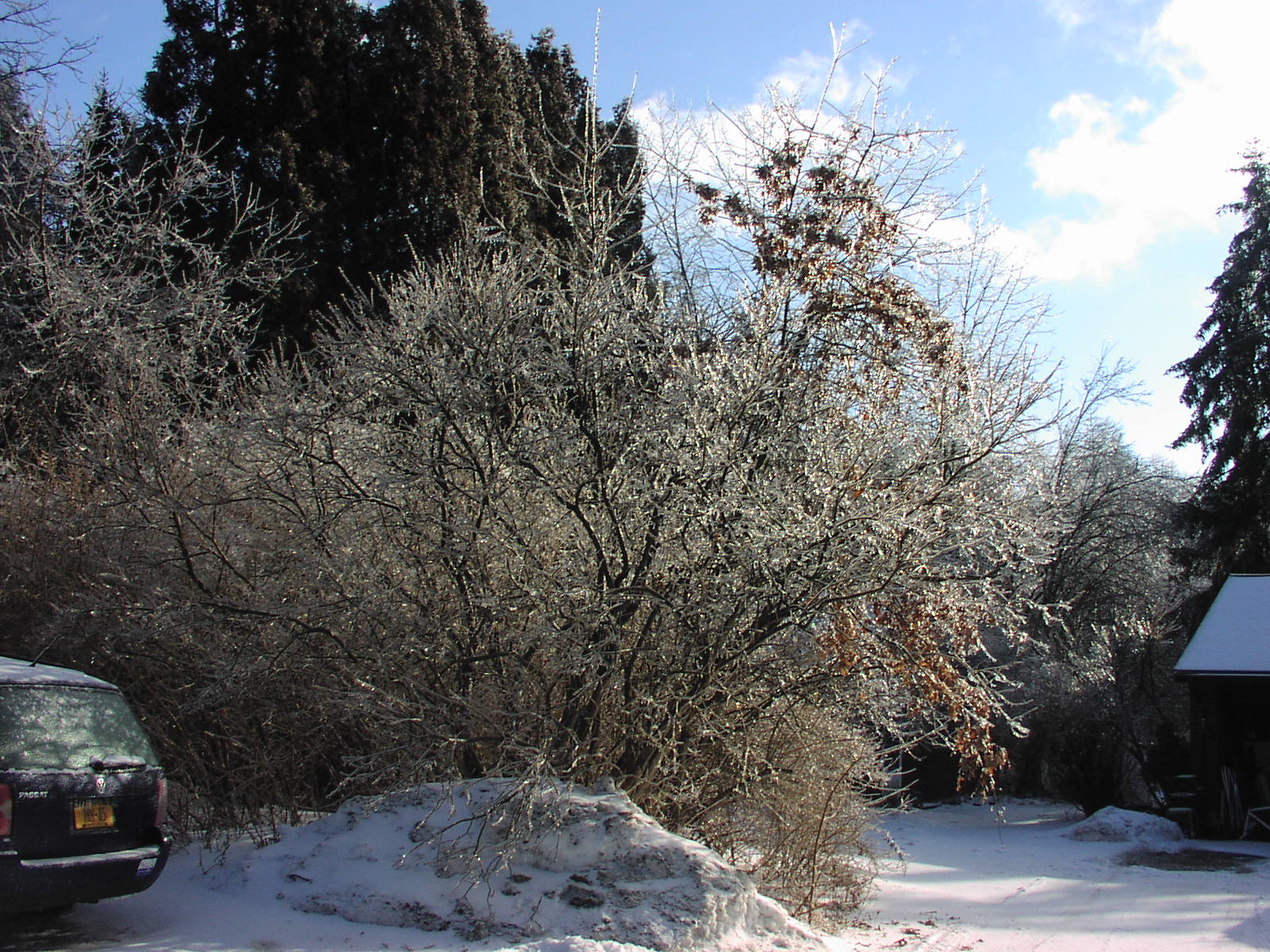
Recap -- Early February Storm Produced a
Range of Ice Sailing Conditions
Snow falling into open water produced a range
of ice of varying thickness and quality. With a temperature
near zero Fahrenheit, it produced a lot of frazil ice or
grease ice that eventually
congealed shore to shore into a surface
layer of "snow ice" averaging 7 - 8 inches in thickness.
Snow ice lacks the tensile strength of black ice that has a
rigid molecular structure that forms
top down from cooling of the exposed surface
to the cold air in the valley. A foot of snow ice on the
river with continued cold is considered safe for sailing,
but good safe black ice was only
found in a few places. At Athens, water bled
up from below over the existing several inches of ice due to
the weight of the fresh snow working to submerge it, but it
was very slow to freeze
and form a good cohesive plate. Fresh snow is
both a great insulator of long wave heat radiation and a
very effective radiator at its surface boundary to the
frozen vacuum of space and that
effectively acts as a heat sink operating at
near absolute zero degrees. It took several days for the
layer of slush to freeze up and integrate with the base ice.
With a spate of warm, windless,
and rainy weather on the way and likely
to take out the ice in Murders Creek, it was decided to send
the boats back to the barn and call it quits for the year.
I don't think anyone at Athens had more than
six active hours on the tiller this year.
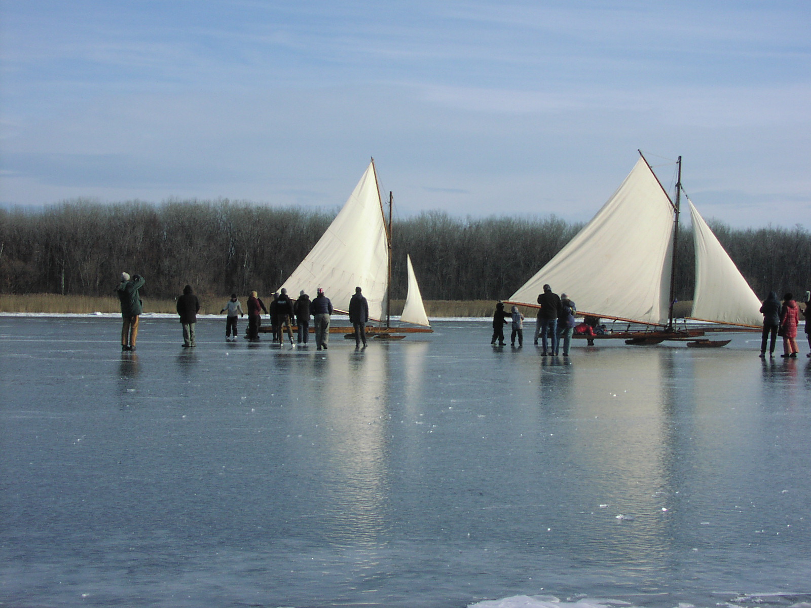
At the North Shrewsbury Ice Boat and Yacht
Club in Red Bank, New Jersey they received twice the amount
of snow that the Hudson Valley did, built a nice sheet of
ice for 10 days,
and were able to run the competition for the
Van Nostrand Trophy to great fanfare from the international
community.
For the first time since it was commissioned,
it is now held by the Hudson River Ice Yacht Club.
There are many great articles and
videos on the Internet documenting the wild weather leading
up to the race and finally the race itself.
In similar fashion, warm and windless weather
the next week forced a quiet end to their season.
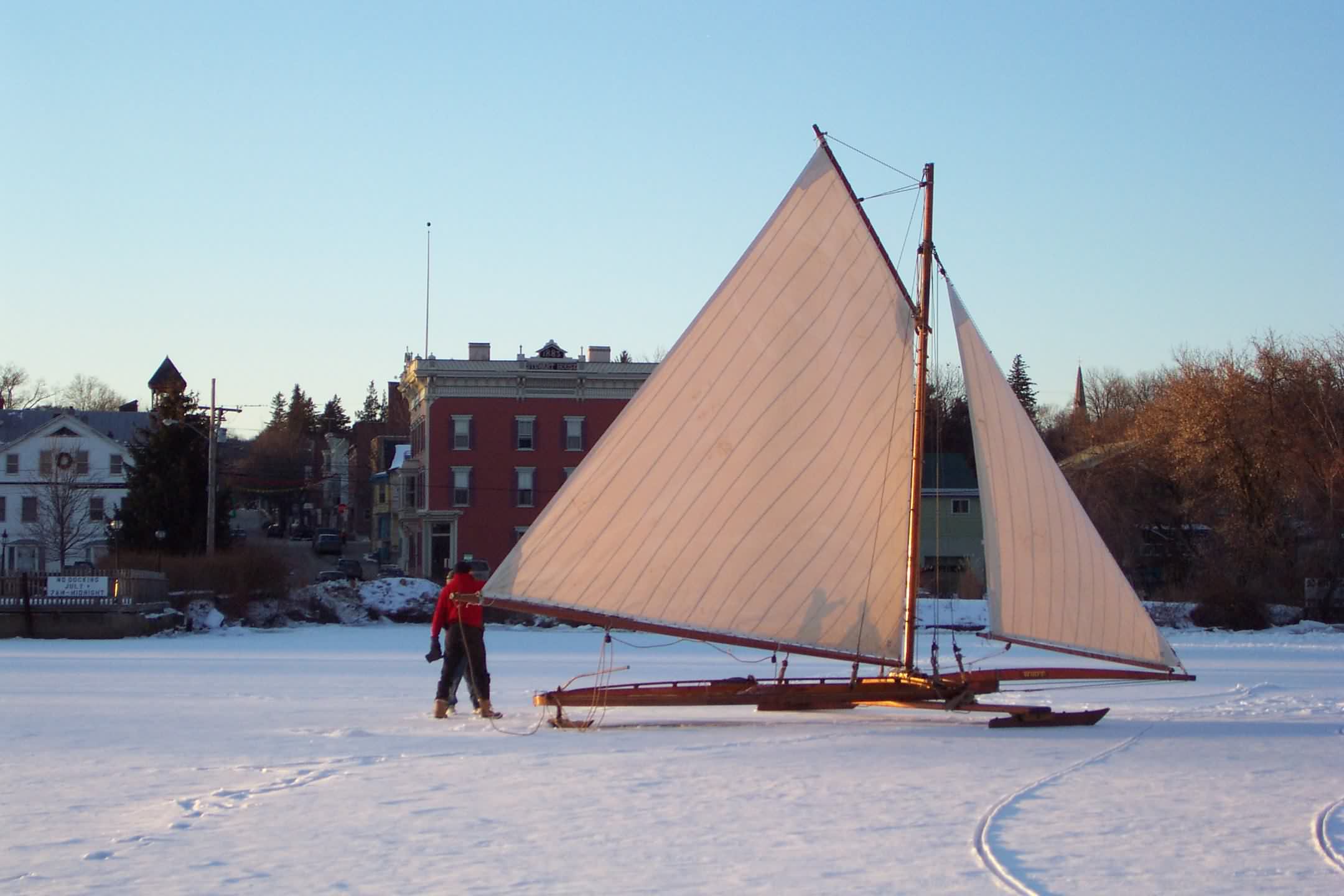
Check out the Lovely Photos by Tara Kearsing
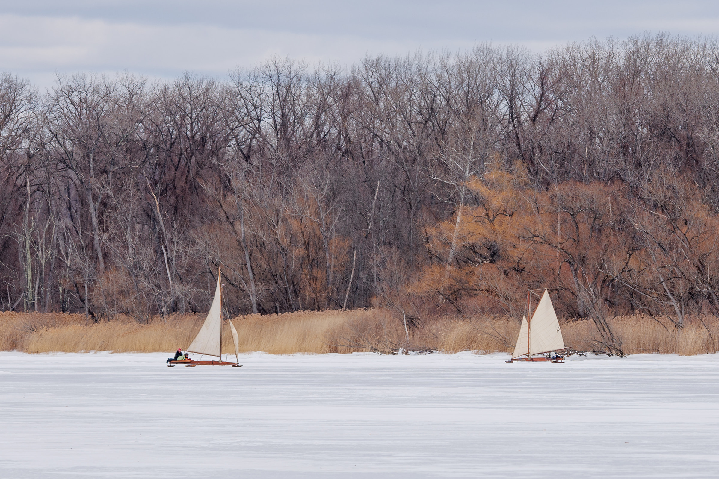
Photo Copyright Tara Kearsing Photography
2026-02-12
Friday February 13, 2026
11 am
Weekend Sailing Not
Looking Promising
There are boats on in Athens NY, but
the wind forecast is not encouraging.
I'm sure there will be people there tinkering with their
boats, skating, and socializing,
but the prospects for good sailing seem small to me.
Iceboats need 12- 15 mph of wind
for steady operation on the snow ice that is covering the
river at this time.
There was a bit of sailing yesterday
and it was cold enough to keep the ice hard.
Today and the rest of the weekend, it looks to warm up where
there might be some
softening and melting of the surface that makes it more
difficult to sail.
With little wind, it will be difficult to do any sailing.
https://forecast.weather.gov/MapClick.php?lat=42.2601&lon=-73.8089
https://extapps.dec.ny.gov/docs/remediation_hudson_pdf/hrefbmapfg.pdf
Area 19 on the map
Athens Boat Launch (Route 385):
42.272987°N, 73.802254°W
Google
Maps -- Athens Boat Launch
Monday February 9, 2026
Noon
Hudson River Ice Yacht
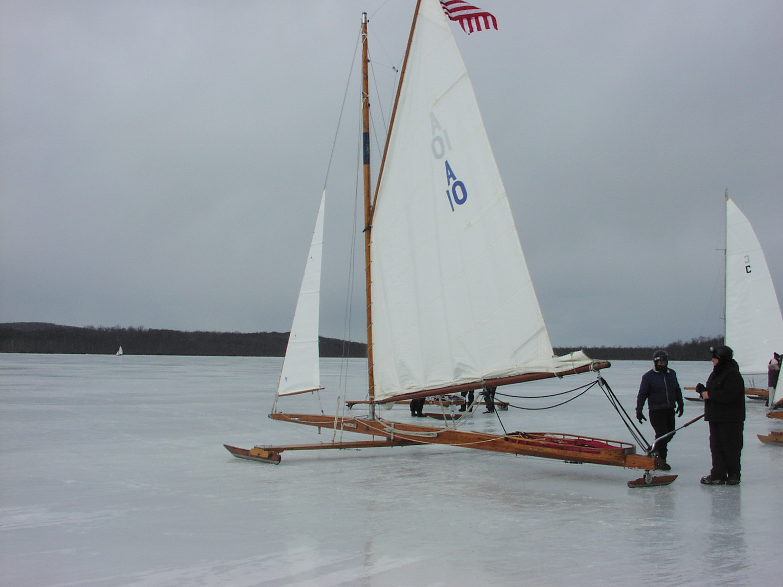
Club Yacht ARIEL Sweeps First Two Races
Van Nostrand Trophy
returns to Orange Lake where it was first endowed
Luke Lawrence wins it
for "PopPop" -- his grandfather --
Bob Lawrence -- a revered figure in local ice yachting
Sunday February 8, 2026
2 pm
Diminishing Wind and
Easing Temperatures
"A" Boat Racing
Monday
in Red Bank?
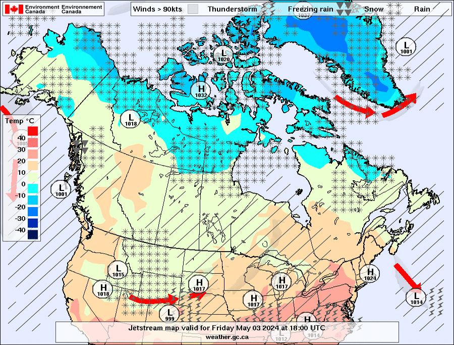
The arctic grip on the northeast will ease this week -- but
light
winds and soft ice are the nemesis of ice boaters as is
snow.
Come week's end, another coastal low bringing rain and snow
may move
north through the I-95 corridor and mess up all the
beautiful
ice that formed up in the wake of the January 26th
storm.
"The
frontal low moves from near Trinidad CO to Nashville TN,
then on to Ocean City MD and then into a deepening phase
past the MA Islands into Nova Scotia by the end of the period.
Precipitation type may be mostly frozen along and to the
left of the fabled Interstate 95 corridor.
I think the GGEM scenario may be the best solution,
dragging some snow all the way to the Atlantic shoreline
after a start as rain."
Meteorologist Larry Cosgrove
https://groups.google.com/d/msgid/weatheramerica
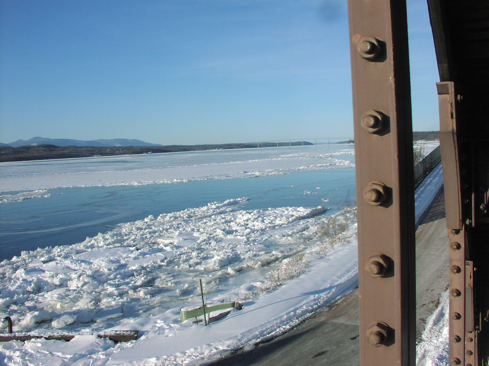
10 Miles of Lovely Ice Forming up on
the Hudson River North of Rhinecliff NY
Weather Links
Updated Ice Science
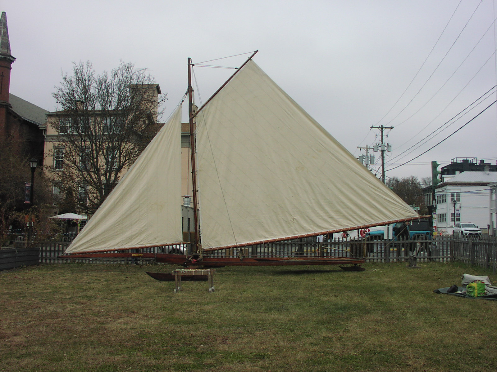
Ice Yacht WHIFF
at the
FDR Winter Show
Presented by the
Hudson River Ice Yacht
Club
&
Hudson River Ice Yacht
Preservation Trust
December 20, 2025 --
January 4, 2026
Wallace Building -- 9 am
- 5 pm
Free Event
A May 1876 article in the Poughkeepsie
Eagle described WHIFF as
“The Finest Ice Yacht in the World.”
WHIFF
is still in the active sailing fleet of the Hudson River Ice
Yacht Club today.
WHIFF
at the Stewart House in Athens
photo by Bob Wills
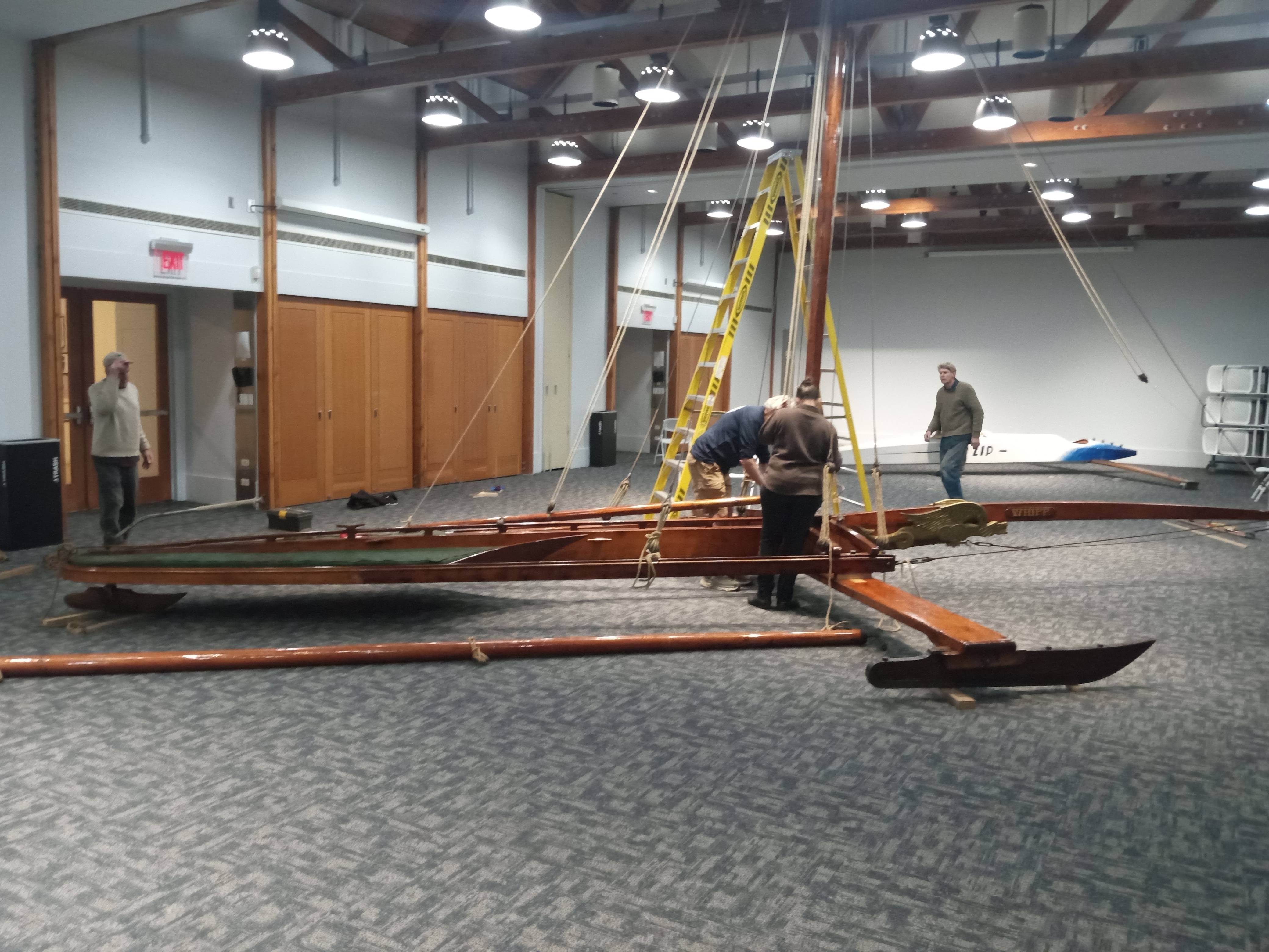
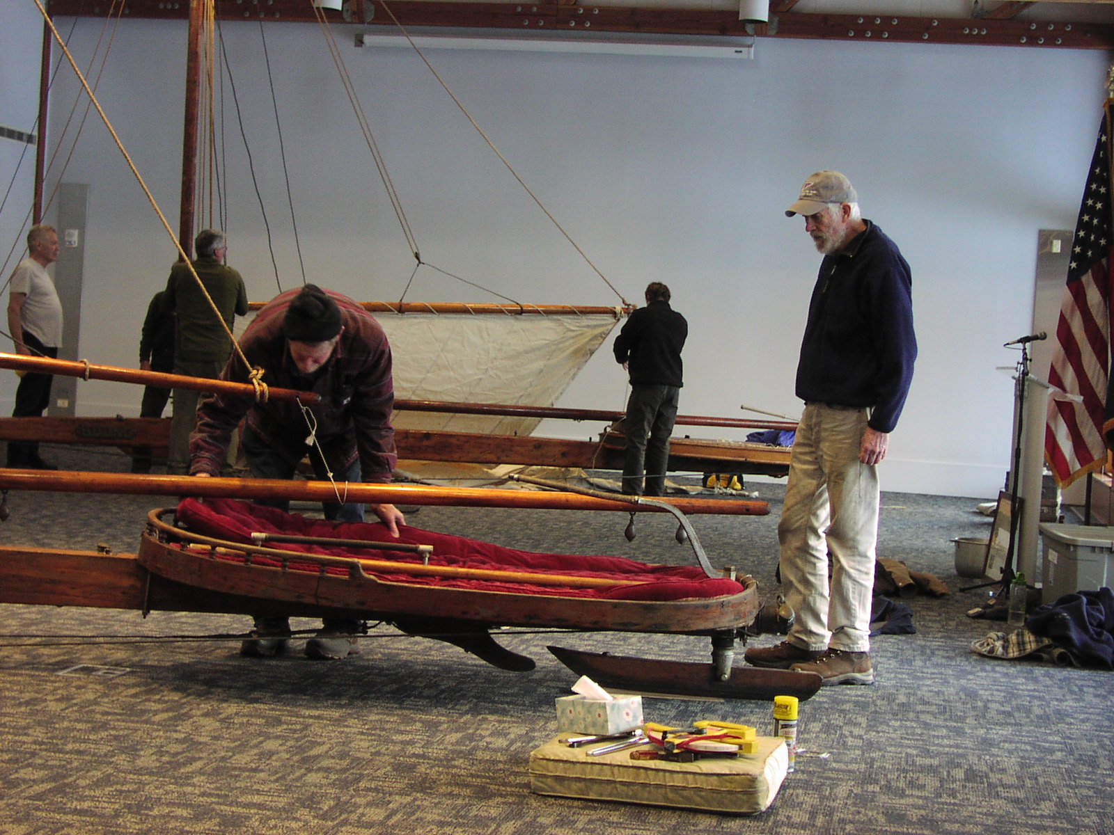
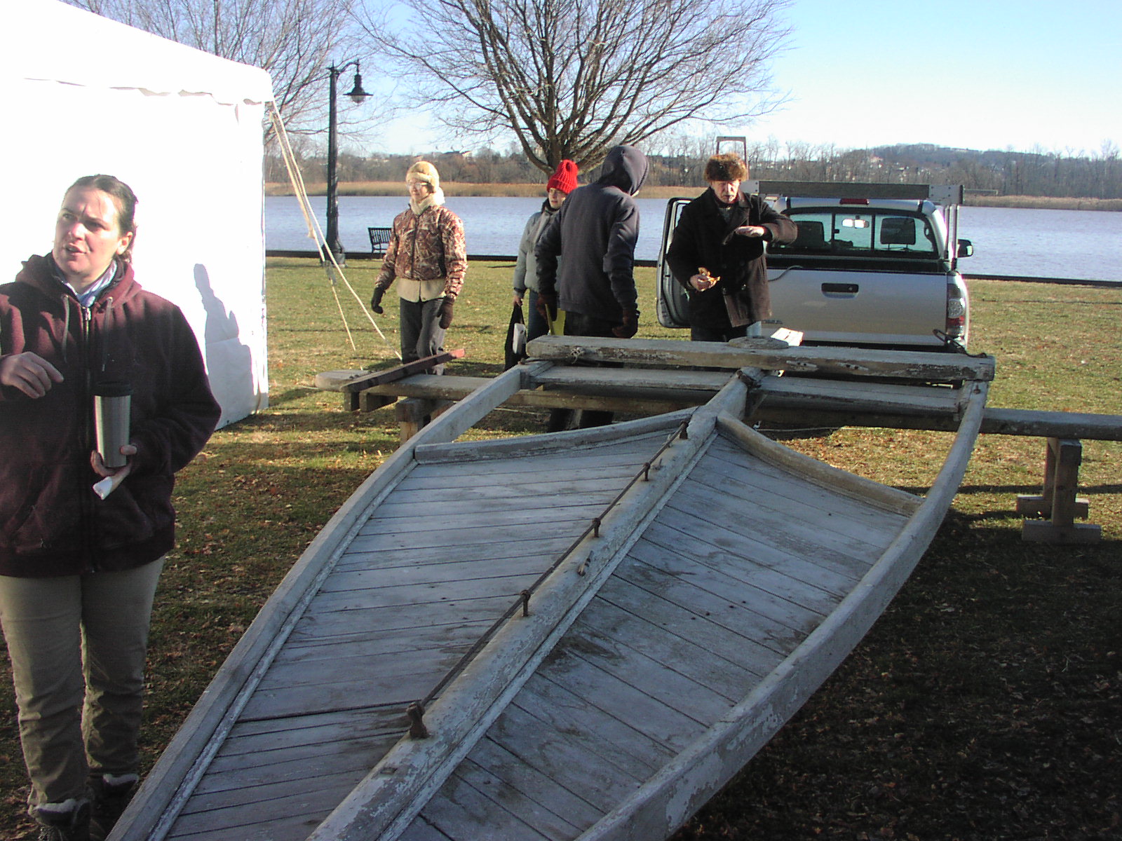
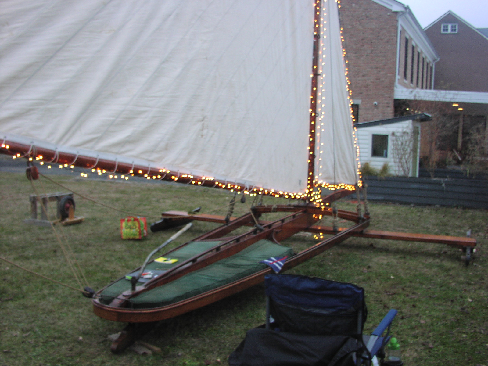
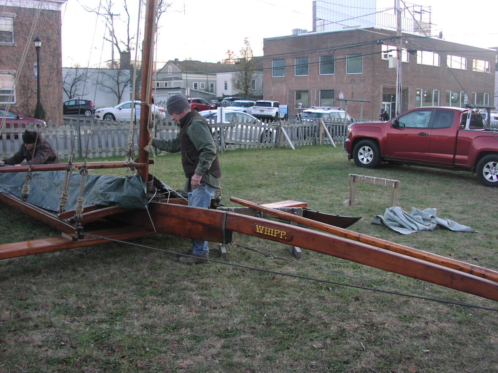
Stage One -- Assemble the frame, spars, and rigging
between the ceiling bays
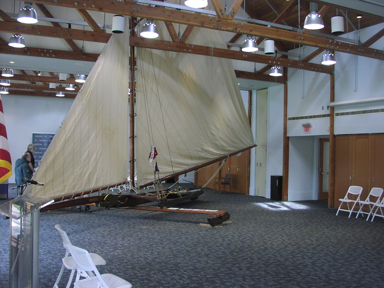
WHIFF neatly tucked in around the rafter truss
with full sail set at the Wallace Center
WHIFF displaying the reproduction griffons
recently carved by Bob Wills
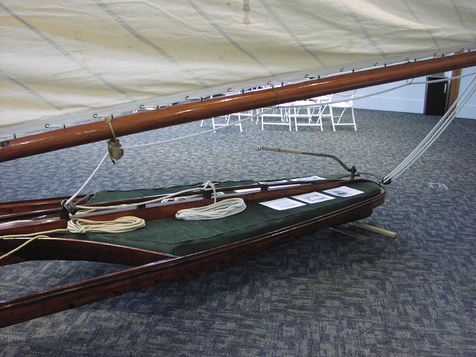
Graceful sculpted cockpit and wishbone frame built by Jacob
Buckhout of Poughkeepsie
Brooklin Maine
Eggemoggin Reach Regatta 2025 Pictures
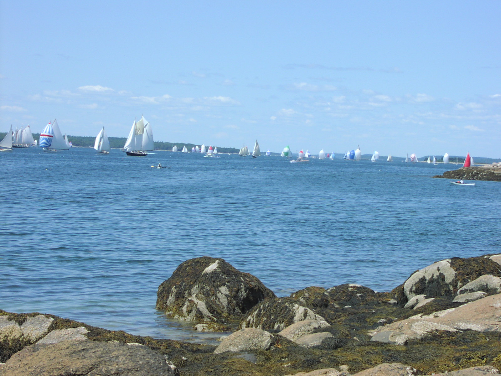
2025 Eggemoggin Reach Regatta Start off
Hog Island
82 Finishers -- Open to Wooden Sailboats > 28'
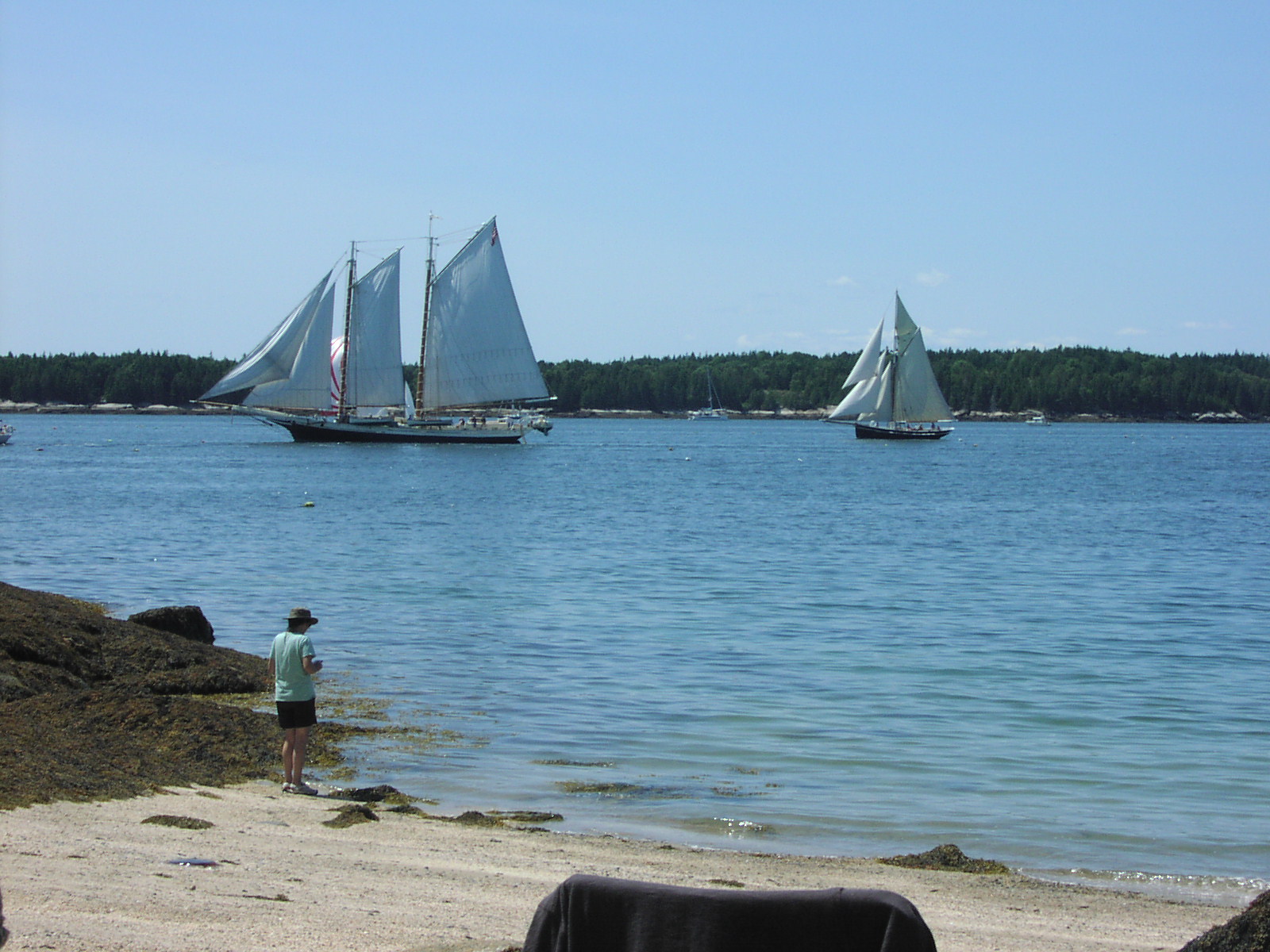
View from the small beach at the base of the HEAD
on Hog Island - crushed shells and sand
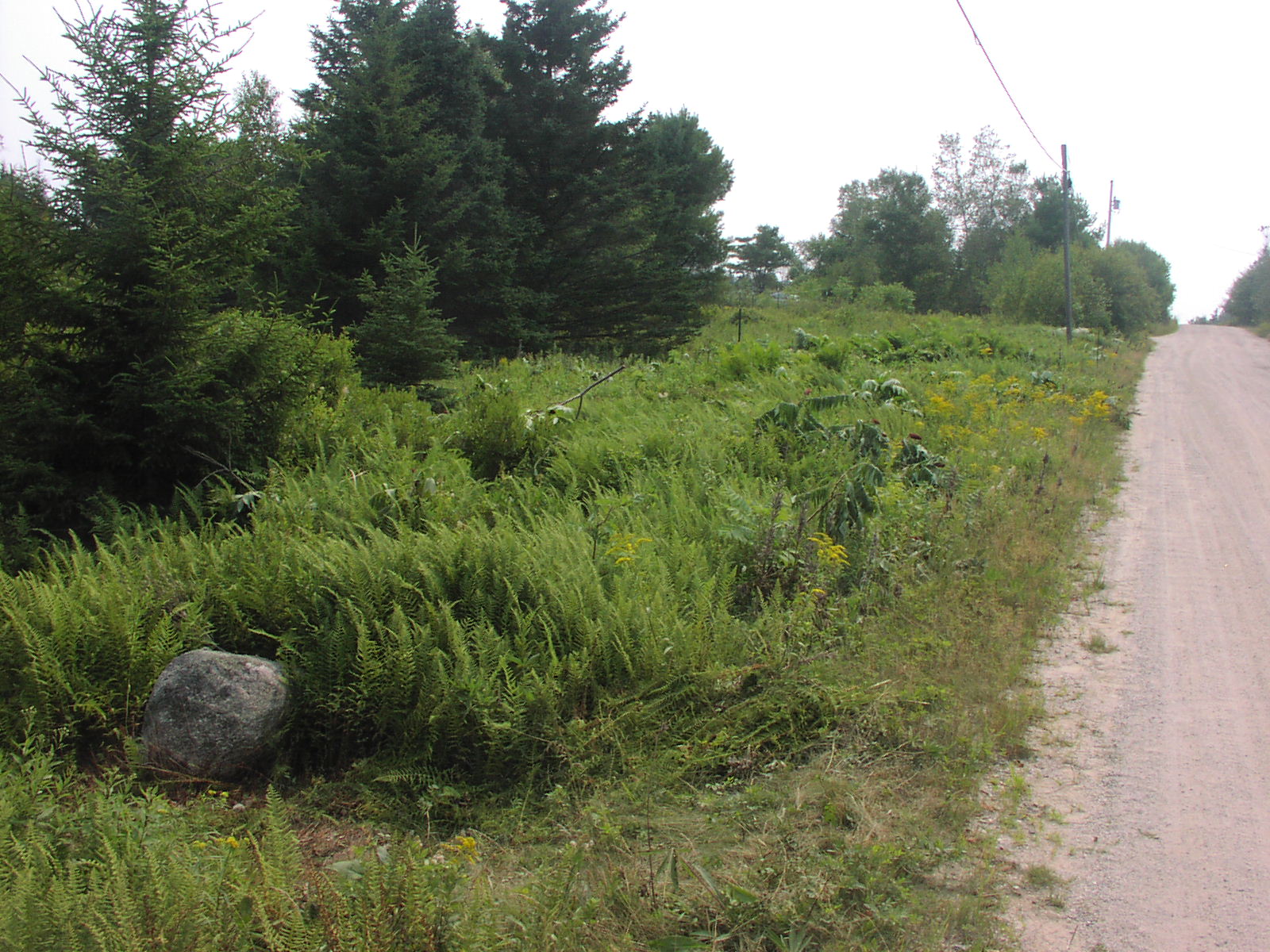
Cutting Ferns and Sumac in preparation for our new driveway
on Radar Road -- note 2 gigabyte fiber on the poles!
Tuesday
-- June 12, 2025
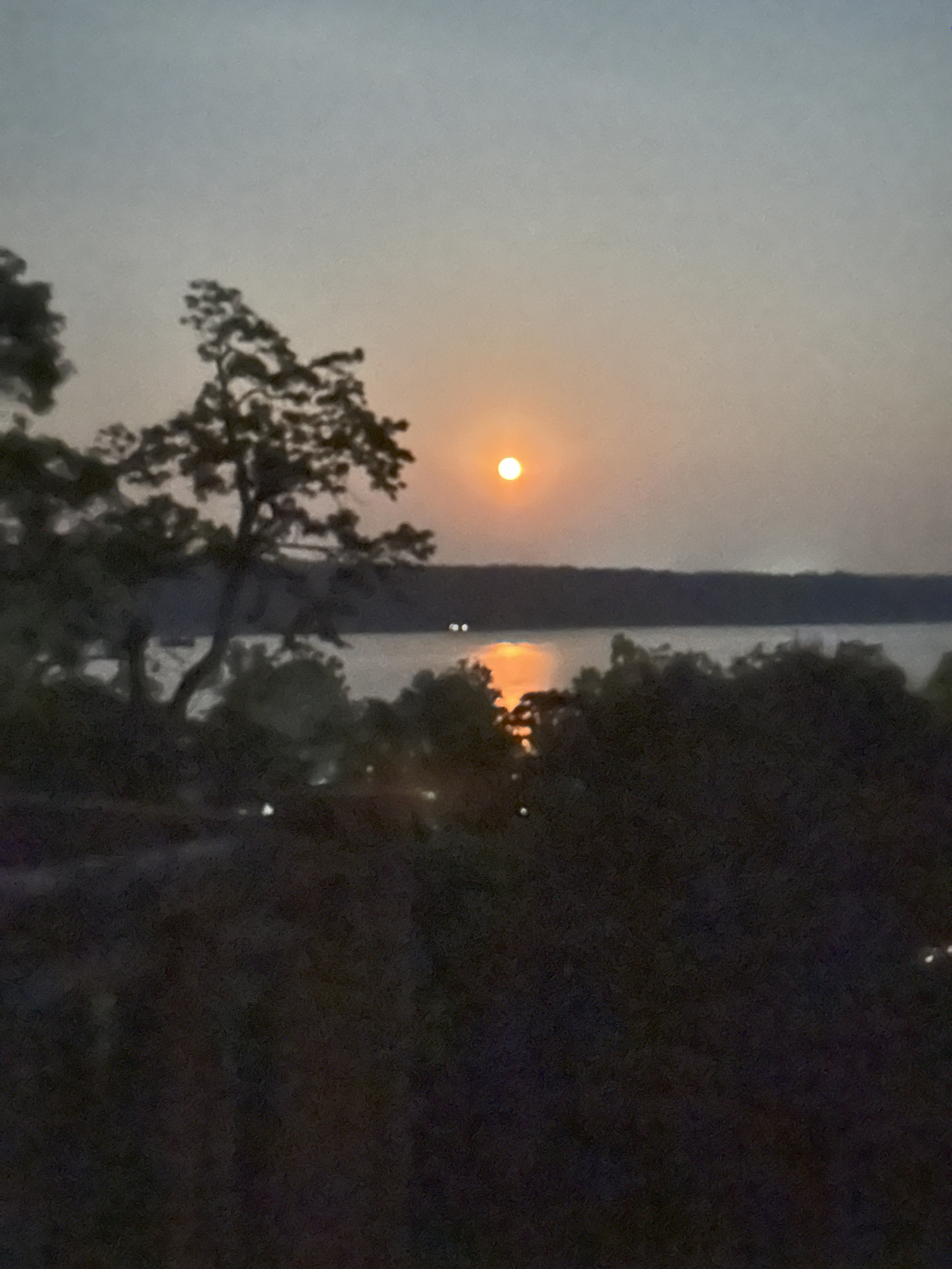
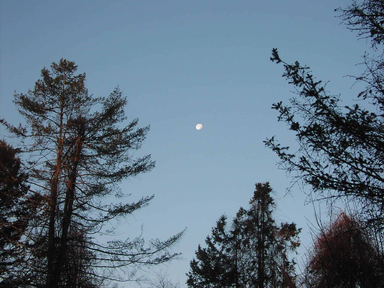
Copyright Patricia Miller -- all rights reserved
Strawberry
Moon Rising over the Hudson River near Ulster Landing
Sunday
-- June 10, 2025
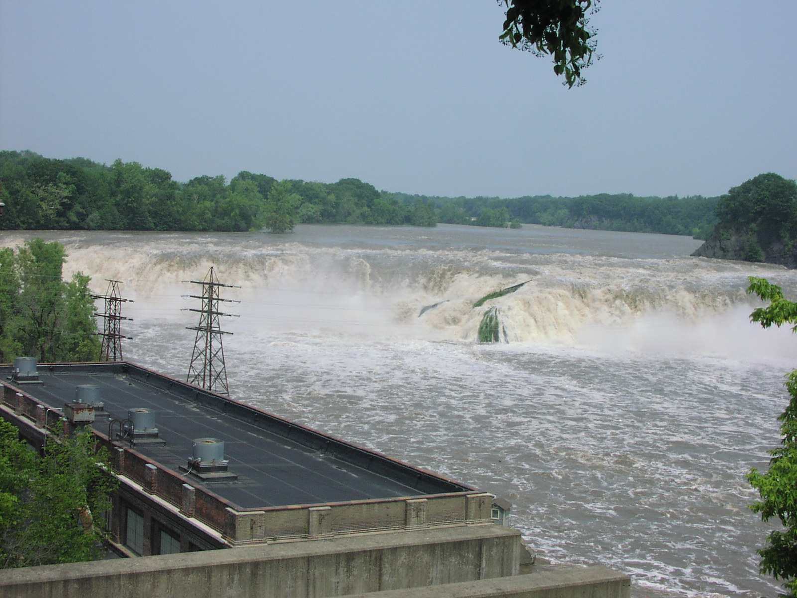
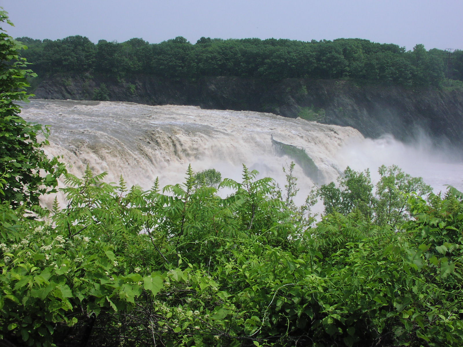
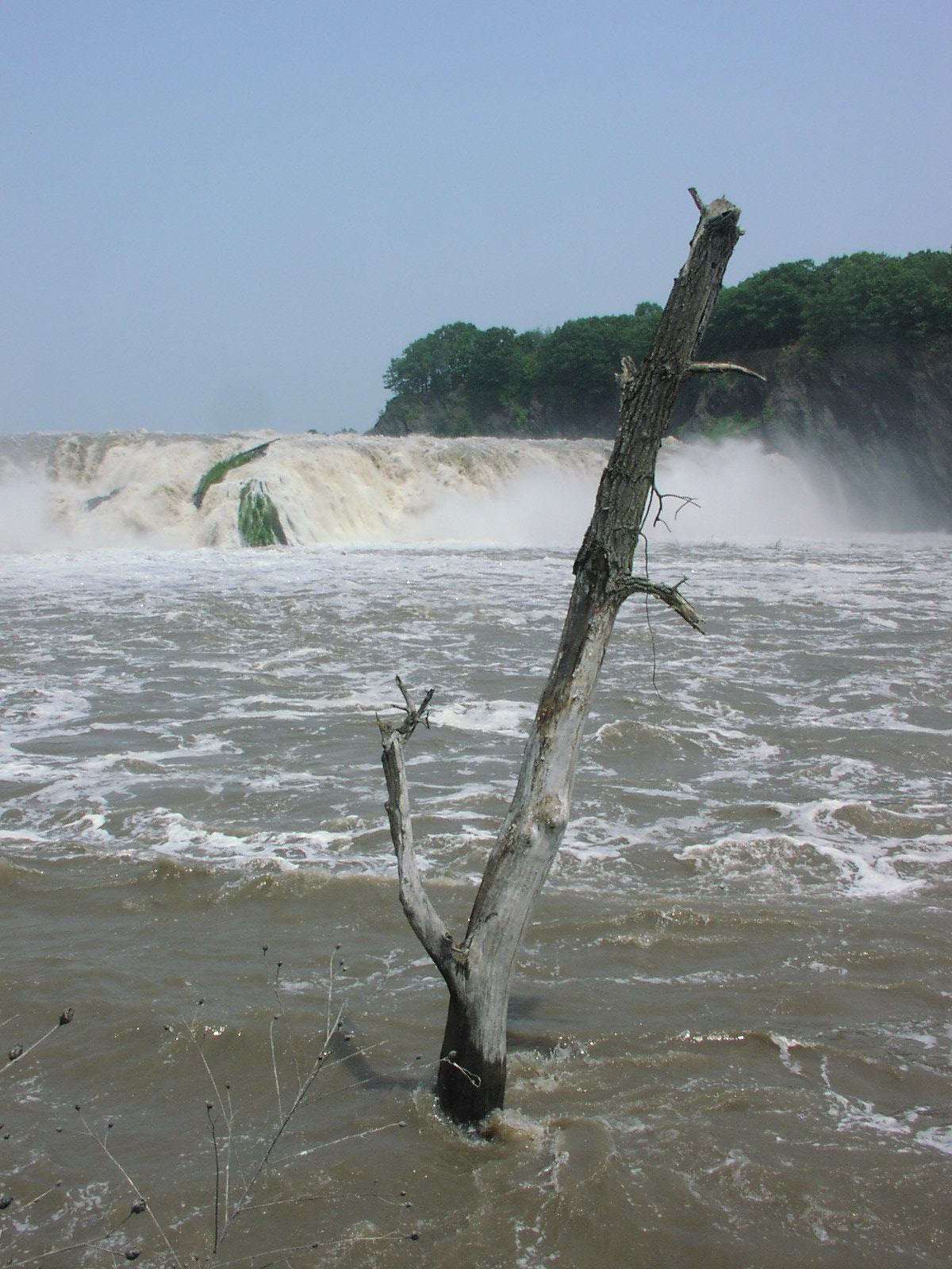
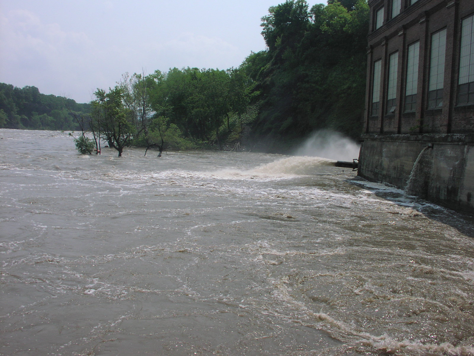
Recent heavy rainfall to our north and
west had the Schoharie Creek, Mohawk River, and the Upper
Hudson River running near flood stage.
Schoharie Creek is unusual in that it flows north out of the
Catskill Mountains until it joins the Mohawk River at Fort
Hunter just west of
Amsterdam NY. The combined flow then descends east to the
Hudson River at Cohoes where it cascades through a gorge
over a ledge 1,000 feet wide
and 60 to 90 feet high. The flow in the following
photographs is about 35,000 cubic feet per second,
approximately 1/4 of the record flow of 143,000 CFS.
Small bushes and shrubs thrive on the rocky promontory in
the center of the falls bathed in a continual mist of
nutrient rich water.
Falls View Park
Hudson
River Ice Yacht Club
Lawrence Farms
Saturday
-- April 26, 2025
1:00 - 4:30 pm
Rain or Shine -- Lots of Warm Dry Indoor
Space in the Retail Room
Kitchen Facility Available -- Cider
Donuts -- Farm Village -- Live Animals
Bring a dish and a favorite beverage
Got photos? Artifacts? Bring them!
THE opportunity to catch up on Club dues!
($25)
Sunday,
March 2, 2025
The Second Day of Spring
Still some sailing on Copake Lake. A high
of 61 F Saturday noon was quickly ushered out by evening as
a sharp arctic
front dropped through the Hudson Valley. By morning
temperatures near zero and stiff winds had VIXEN back
in action for the day.
Yes, that is open water near the inlet stream.
Wednesday,
February 26, 2025
4 am --
35°
F -- The Meltdown Continues -- No Sailing Reported
(Right Click Images and Open in a New Tab
for Full Resolution)
| After a two week spell of weather
colder than we have seen over the past five seasons, the
switch has been thrown and it is back to above average
temperatures and sunny weather. This will quickly soften
and thin the ice and set the process of dismantling the
remaining boats on Orange Lake in motion. Meteorological
Spring begins on March 1st, and will be ushered in with
temperatures near 50 and rain. I think all locations
from Albany south will be done and free of ice safe
enough for sailing in another week. The forsythia is
already budding out and the birds are singing their
spring songs. I did see a snowy owl hunting mice in the
big fields along Budds Corners Road Friday evening, but
I suspect it was on the wing north to its preferred
summer habitat.
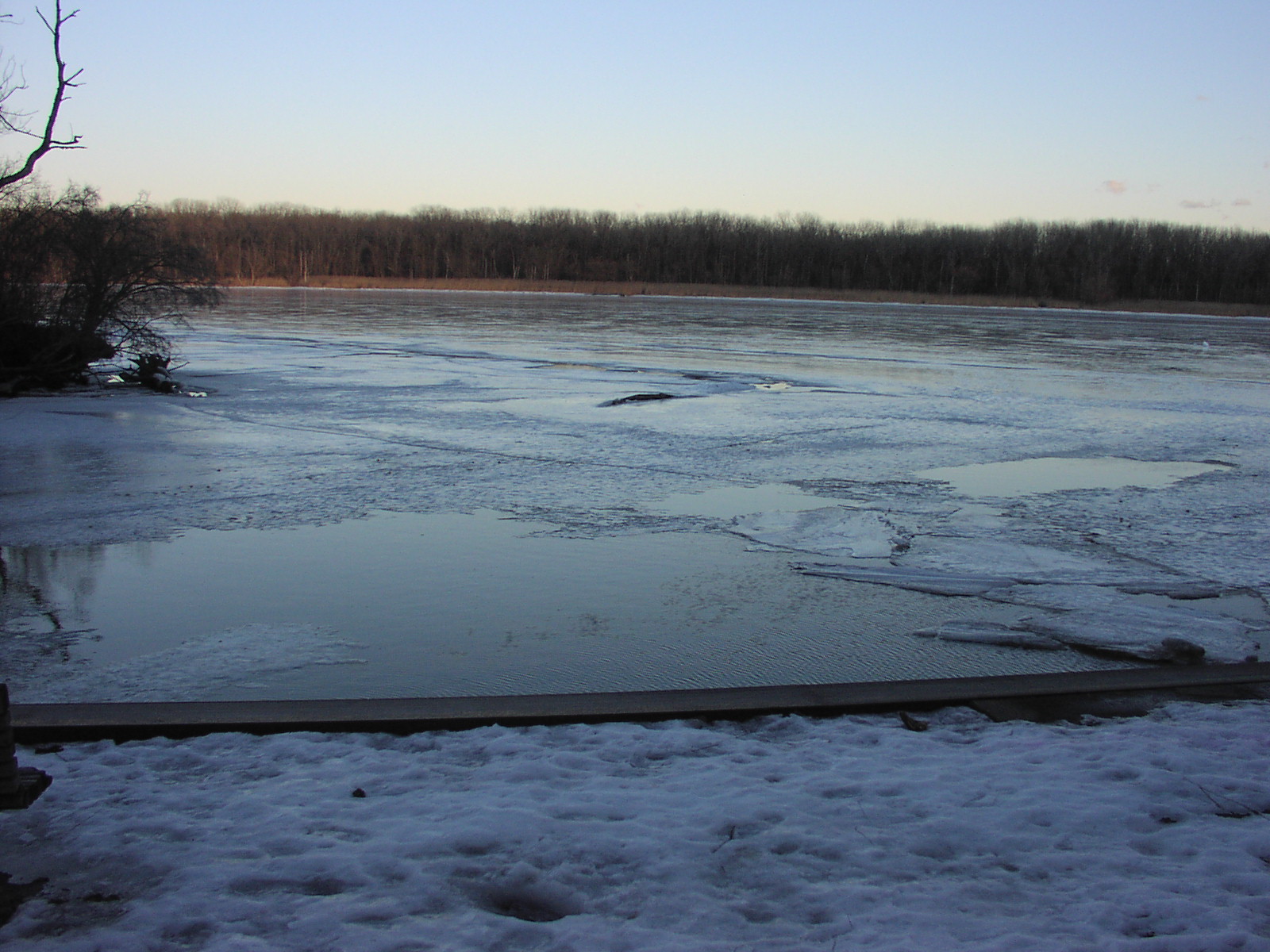
Ice on the main stem of the Hudson
River never gained enough thickness to take a set. At
Rhinecliff Saturday afternoon, the entire sheet was a
messy jumble of broken brash ice floating freely with
the tide. Access at Tivoli Bay remains elusive -- the
soft ice there will be quickly gone as the rain, high sun,
longer days, and the spring runoff take it apart.
Larry Cosgrove's round up of the weather for the next 30
days shows nothing but above average temperature
expectations for the northeast. "And So It Goes" in this
era of global warming. It looks to be 40 - 50°
F almost every day for the next 10 days at Poughkeepsie,
although
True Weather and others are hinting at a major storm
sweeping through the northeast next week. |
| |
|
 |
| |
| |
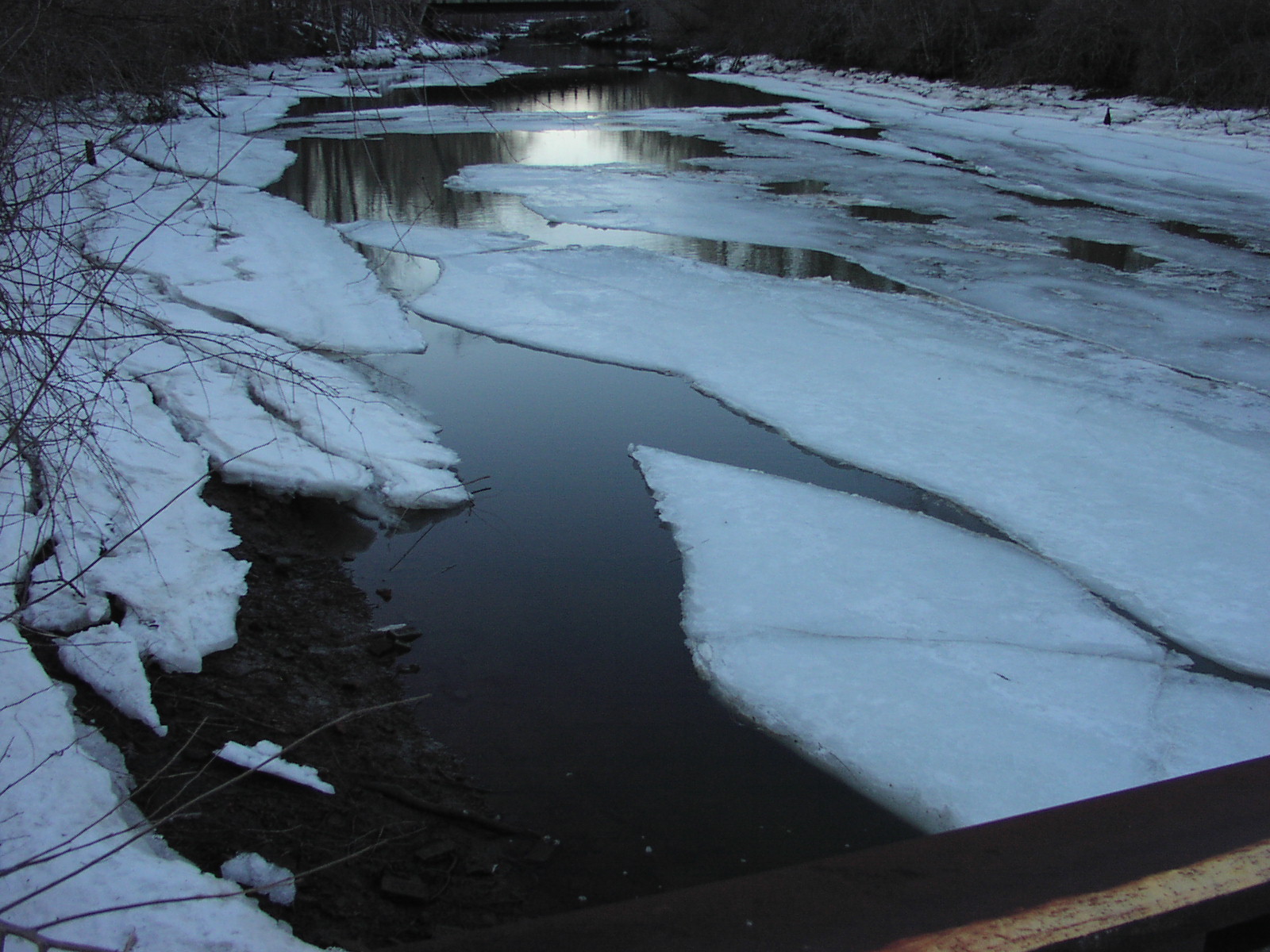
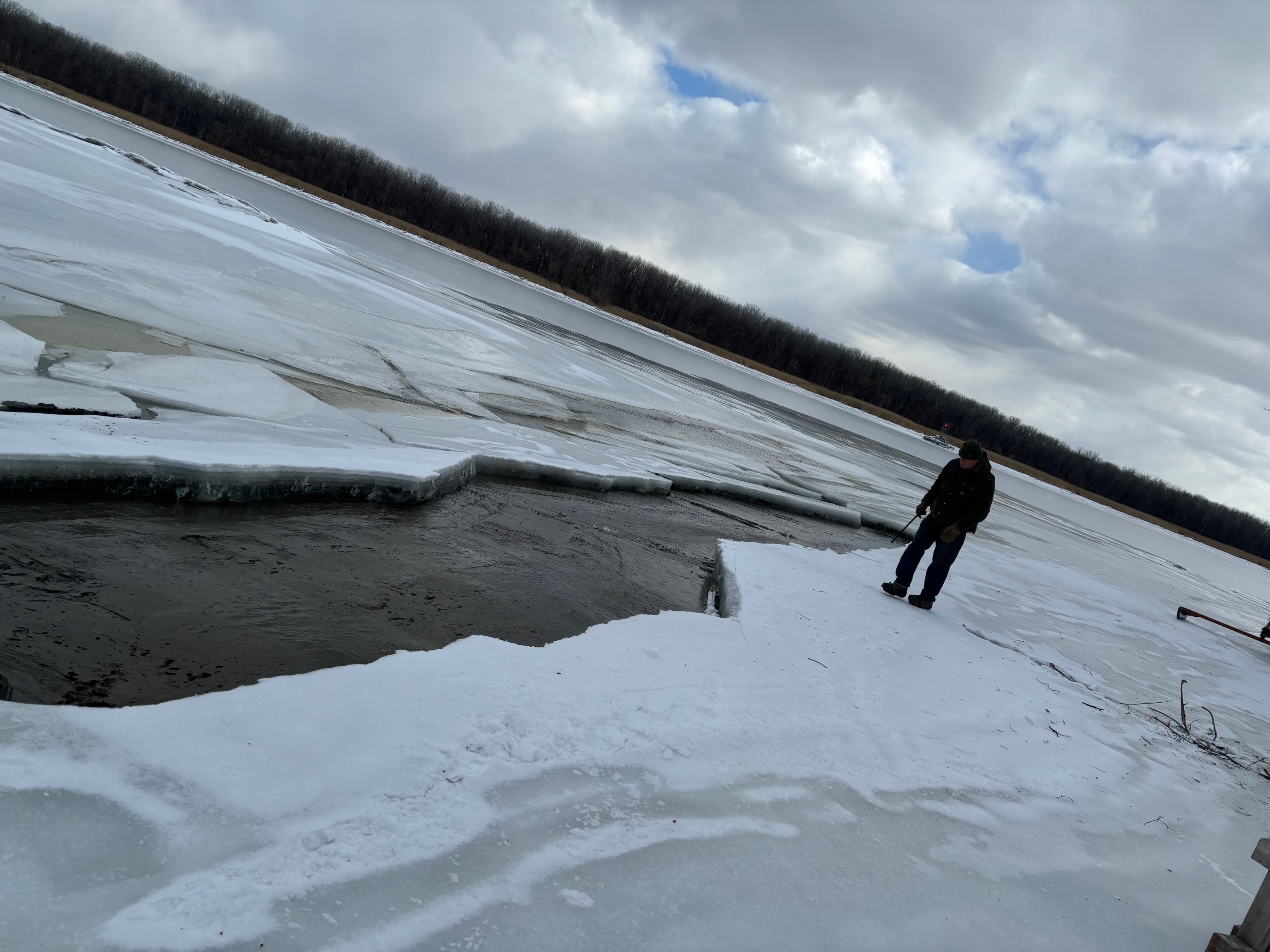
| The storm of last Sunday made a real mess of the ice
at the launch site in Athens at Murderer's Creek. Brian
Reid posted photos on his White Wings and Black Ice web
site that document the scene very nicely.
The storm
quickly went from snow to sleet, freezing rain, and all
rain in the Hudson Valley. Falling on the upstream
reservoir known as Sleepy Hollow Lake, the weight of the
precipitation on the ice and the accompanying rise in the stream
inflow to the lake quickly displaced 15 - 25 million
gallons of warmer bottom water down Murder's Creek to
the launch area. As the
tide fell the weak sheet of ice in the creek fractured
and slid down the mud into the middle of the creek.
Whiff was left stranded on a small piece of ice clinging
to the south bank of the creek. |
| |
| |
| |
|
 |
|
https://hudsonrivericeyachting.blogspot.com/2009/12/ice-conditions-121416.html
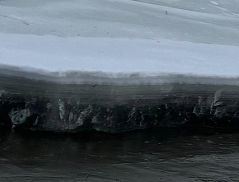
If we zoom in on the
image we can see the many layers of the ice sheet. The
3" of black ice at the bottom has fairly good tensile strength, but
the upper 6 or 7 layers of sleet and snow ice that make
up more than half the total thickness above it are junk -- new,
weak and unconsolidated that failed under the weight of
the sheet bending and collapsing as the tide dropped it
into the vee shaped channel. Good hard ice is quite
plastic and might have survived. I've witnessed that
sailing across hill and dale in the drainage channels of
the north end of South Bay. |
| |
|
 |
| |
|
 |
|
With the Arctic Blast, ice begins to
form up after a week.
|
|
 |
|
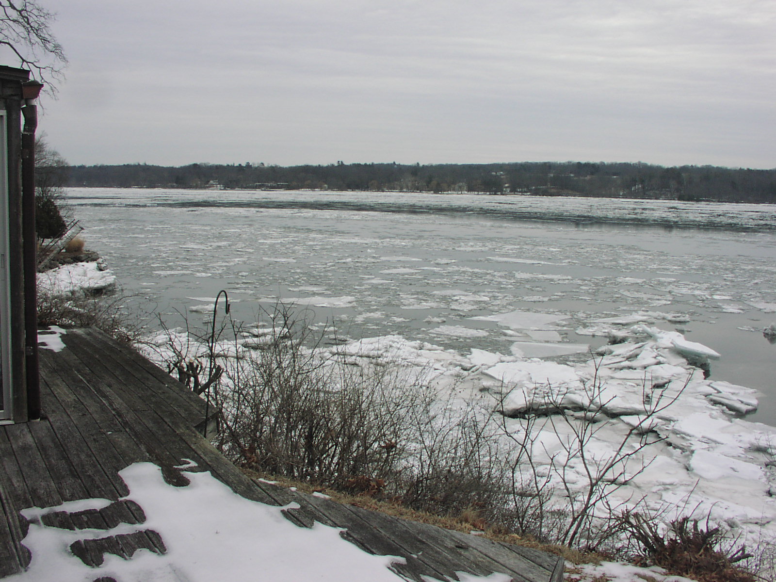
From Rhinecliff up to the bridge, it
is still a lot of open water.
|
|
 |
|
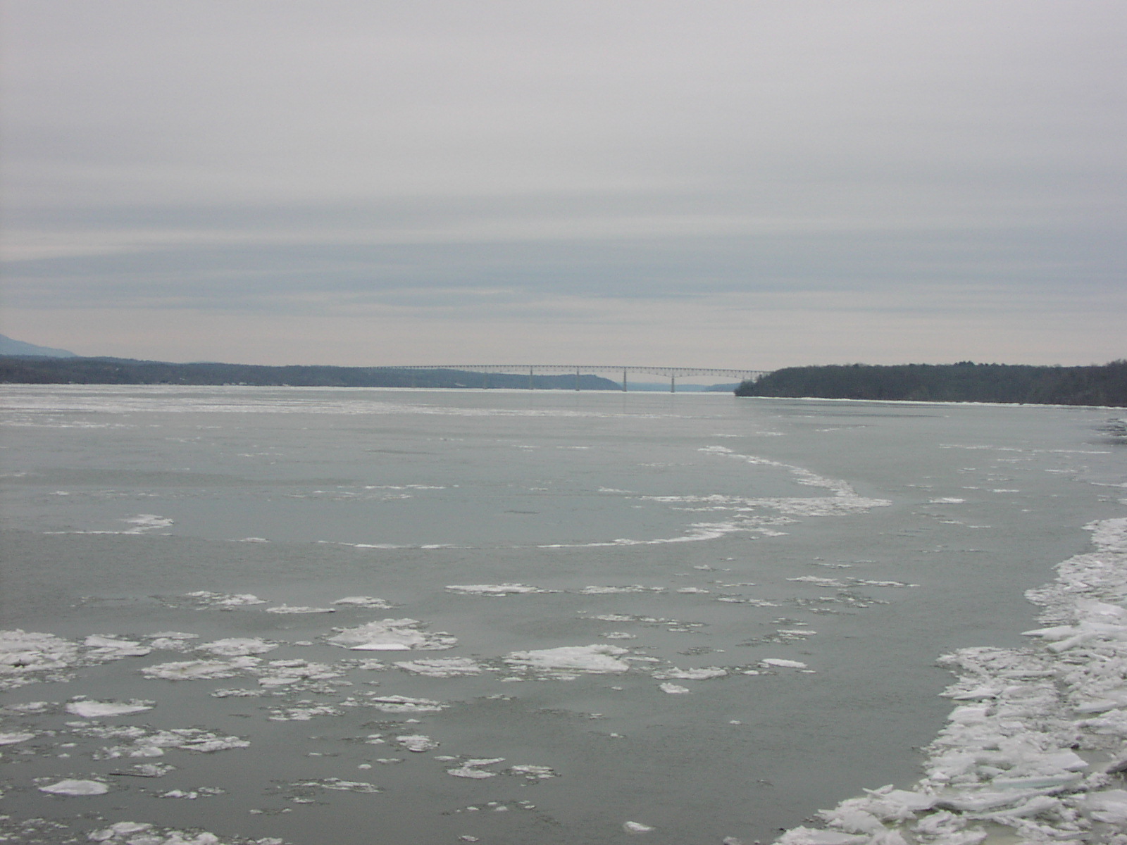
A week later, and there is still a lot
of open water with the brash ice drifting on the tide.
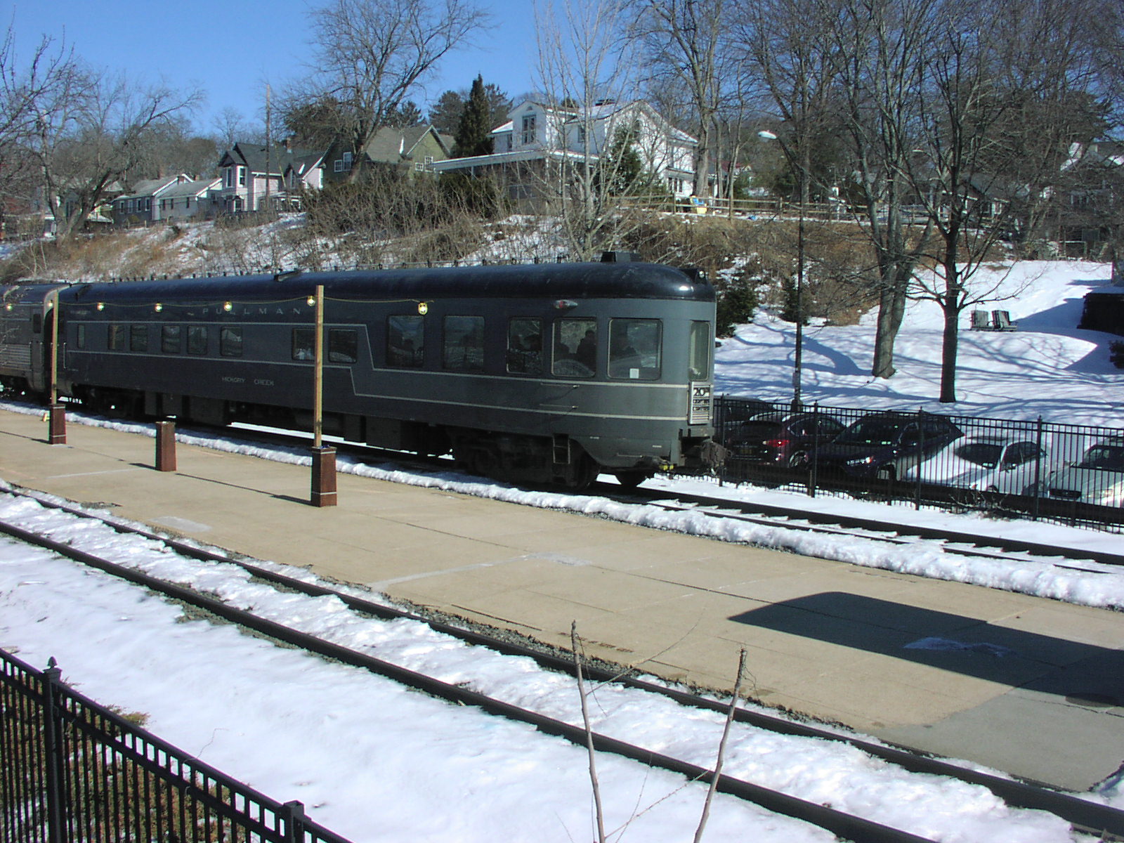
Hickory Creek Pullman car in Rhinecliff bringing up the
rear end
of the Lake Shore Limited Amtrak Express to Chicago. |
Wednesday,
February 19, 2025
Urgent Plea -- Stay off the Ice on the
Hudson River -- It is not Safe
Regardless of What You May Read Elsewhere,
Please Heed my Warning
Six inches of ice is not safe on the
river - it may look fabulous but it is dangerous.
I've been railing about this for at least 10 years, but
people are not listening.
We've had two people go through at Murderer's Creek in the
past.
Boats have been stranded and people endangered while
the emergency plea goes out for help to get them off the
ice.
We had snow, sleet, and rain this past
storm -- it was completely predictable
that Sleepy Hollow Lake would dump a lot of warm water down
the hill
and erode the launch area.
The six or seven and a half inches of "ice" others are
reporting is a joke -- just look at it.
Maybe three inches of hard ice on the bottom and the rest a
mix of low
flotation snow ice and soft sleet frozen together.
Easily eroded from top and bottom and barely enough tensile
strength to hold it together.
Putting boats on this junk is creating an
attractive nuisance that is going to get
people injured or worse. It's irresponsible and needs to end
now.
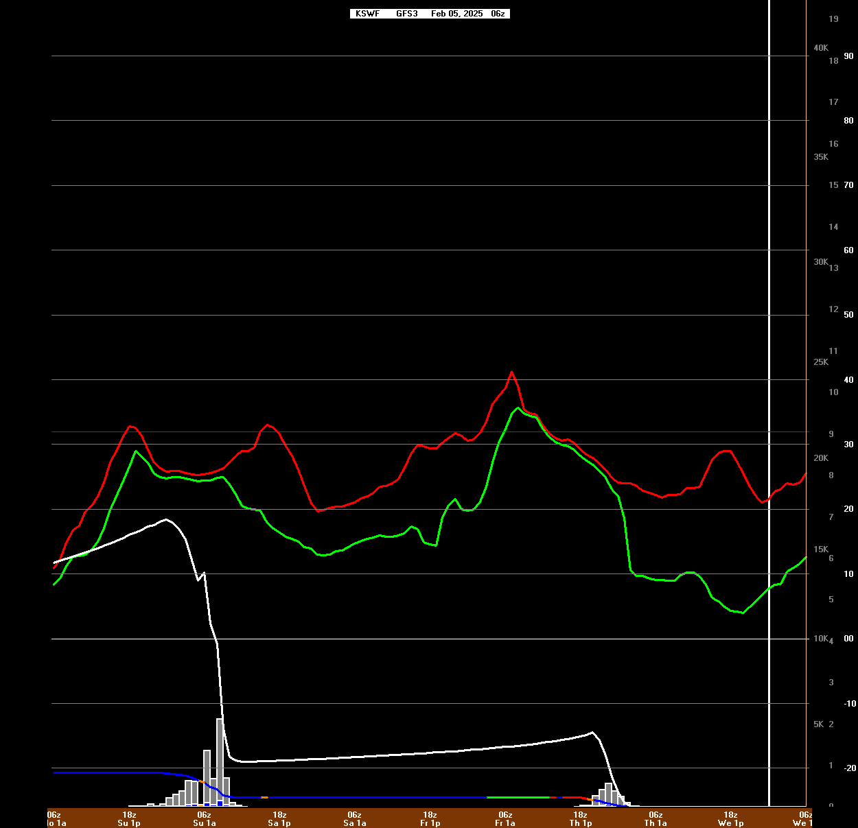
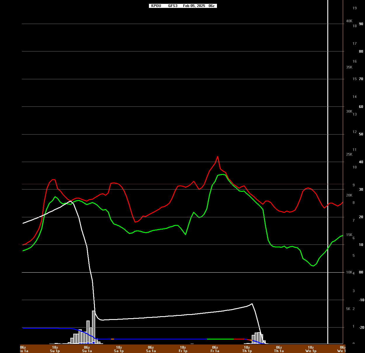
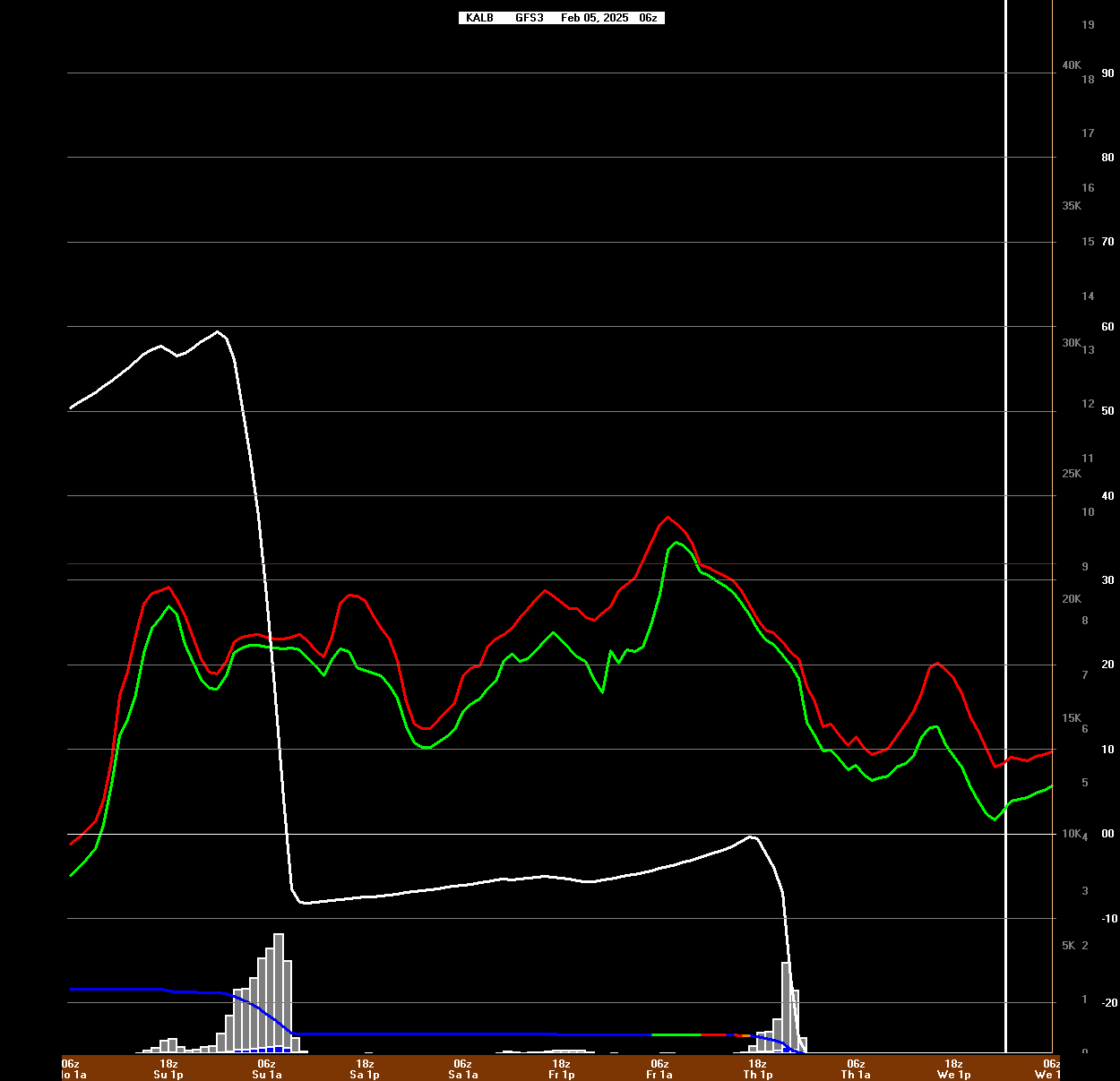
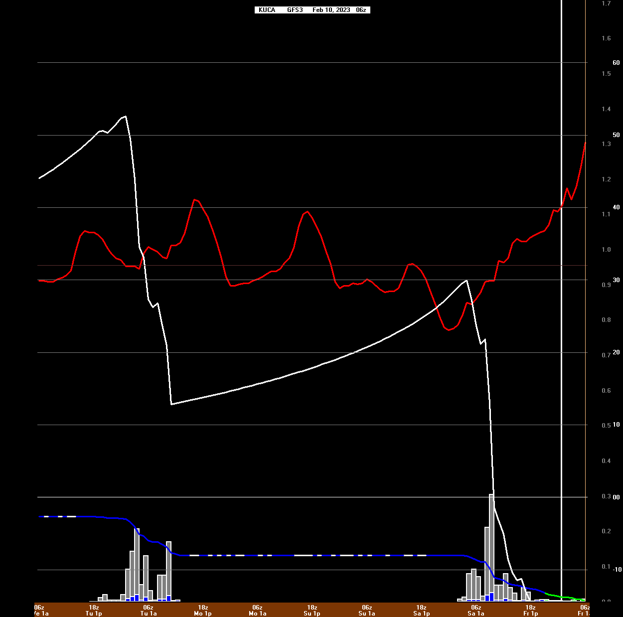
Wednesday,
February 05, 2025
Snow, Freezing
Rain, and Rain in the Forecast through the Weekend
7 am
21°
F
A near repeat
of last weekend looks to be in the offing but with a more
potent storm moving through.
From left to
right we go south to north from Orange Lake to Poughkeepsie
and Albany.
Colder
temperatures north portend more snow. The red line is the
temperature, white is the snow total.
At the bottom
is the precipitation type. Red and Orange are freezing rain
and sleet. Green is rain. Blue is snow.
Thursday looks
to be a mess for everyone -- be careful on the roads if you
have to go out.
With no arctic
air in sight, this will make a mess of the ice as well.
Places that were safe will become soft and dangerous.
Be safe and
avoid going on the ice until the situation stabilizes.
Wednesday,
January 29, 2025
Snow, Freezing
Rain, and Rain in the Forecast through the Weekend
7 am
29°
F
When the daily average
temperature is above 20°
F we are losing ice.
Boats were pulled off the ice Monday afternoon due to our
insecurity
about the ice conditions at Murderer's Creek in Athens. The
warming
weather, softening ice, threats of snow, open water in the
main channel,
strong tides, and no arctic cold air in sight on the weather
map were all factors
in the retreat from the ice. The boats are on the truck
ready for the next round.
Glen Burger's GoPro Video
See Brian's
Report
https://hudsonrivericeyachting.blogspot.com
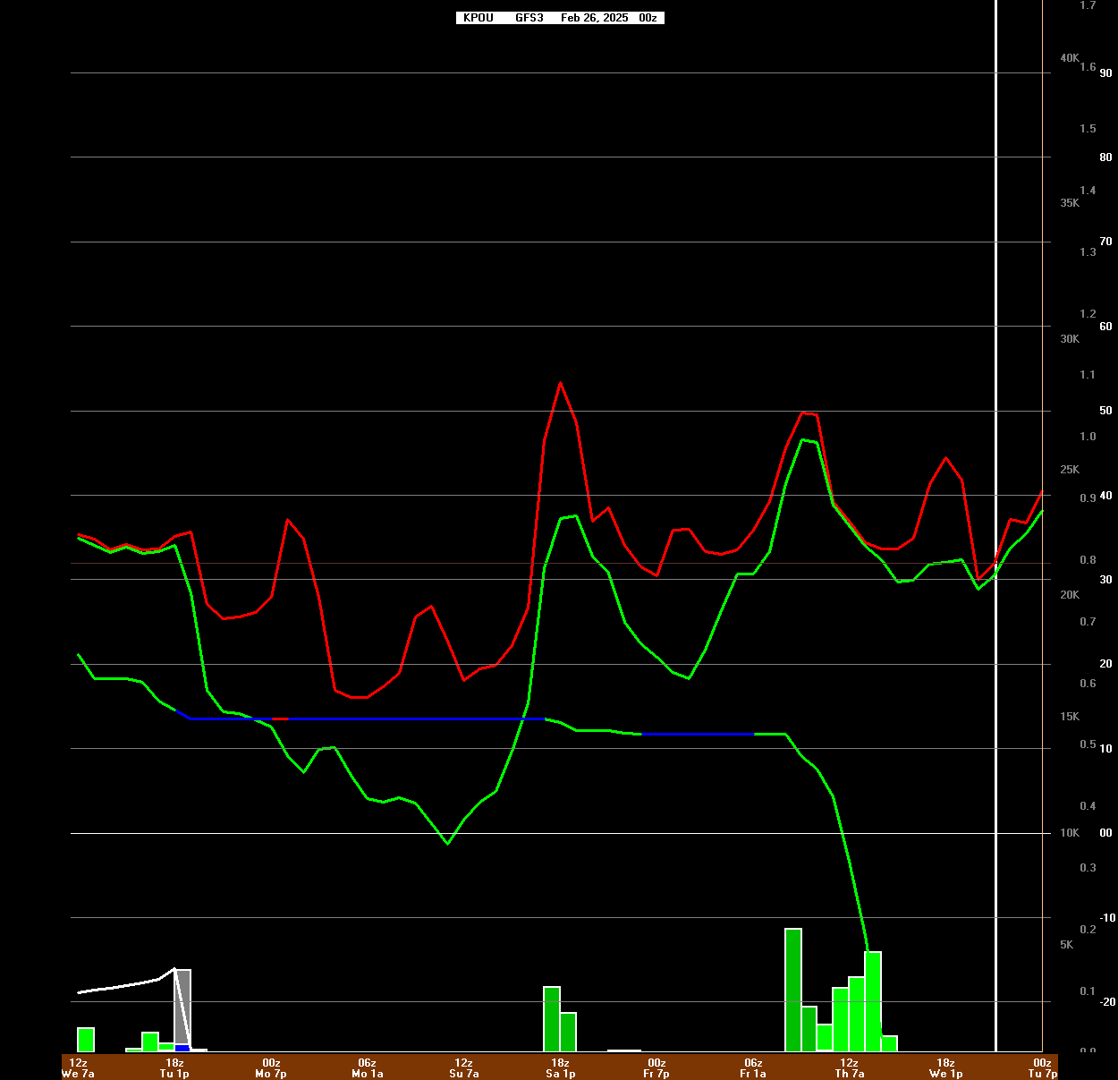
Monday, January 27, 2025
7 am
20°
F
The high wind
did not materialize yesterday afternoon and good sailing was
had by the fleet.
Here's the
BUFKIT output for the GFS forcast for the next few days --
perhaps 1 - 4 inches of snow early Wednesday.
Note that time
runs "backwards" in this NWS product.
Red and Green lines are Temperature and Dewpoint.
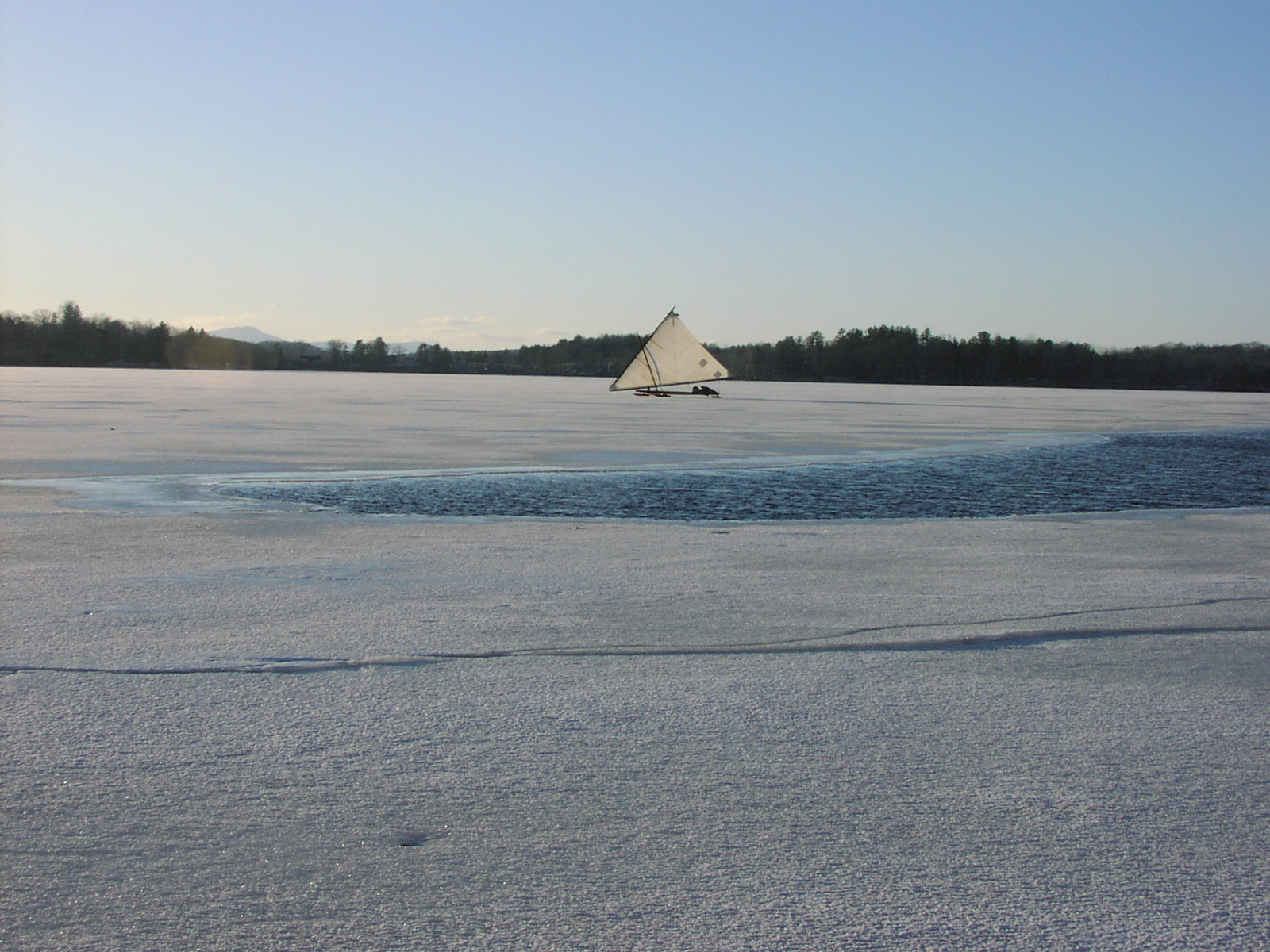
Sunday, January 26, 2025
10 am
29°
F
There is
sailing in the West Channel of the Hudson River at Athens NY
-- Access is the
DEC Fishing Ramp just north of the Village on Rte 385.
Over a half
dozen boats were on the ice at sunset. Whiff,
Orion, Hound, and Galatea had a busy
afternoon giving rides to a hundred or so spectators.
As the
afternoon wore on, more boats arrived, the sun faded, the
wind increased, and people drifted off primed to return
early Sunday.
Today the best
sailing will likely occur before early afternoon when a
frontal boundary arrives and chases out the warmer air.
With the
frontal passage, the wind is forecast to become too strong
and gusty (20 - 30 mph) for safe sailing and most will be
done for the day.
Orange Lake is
dealing with a crusty surface from the snow that fell onto
wet ice last Sunday. High wind will be a problem today.
Hound (1900) and Whiff (1875) on
the ice at Athens NY 2025-01-25
photo © jsperr
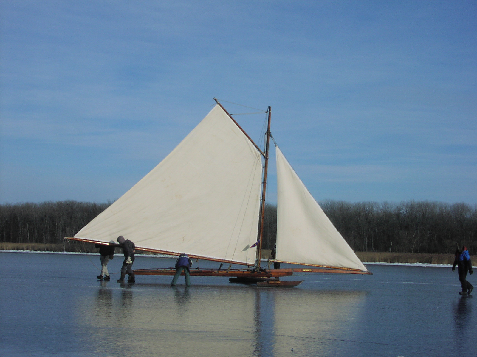
Whiff (1875) on the ice at
Athens NY 2025-01-25 photo
© jsperr
right click photos to open full
size
More
pictures on Brian Reid's website
White Wings and Black Ice
Monday,
January 13, 2025
7 am
30°
F
A Quick
Reminder -- Use Extreme Caution if You Venture on the Ice --
It's Not Ready in Many Places
The recent
cold snap has built ice in many places, but many are not
"locked it" yet. Be careful!
Two People
Went Through on Sacandaga Reservoir Recently -- One Died,
the Other Hospitalized
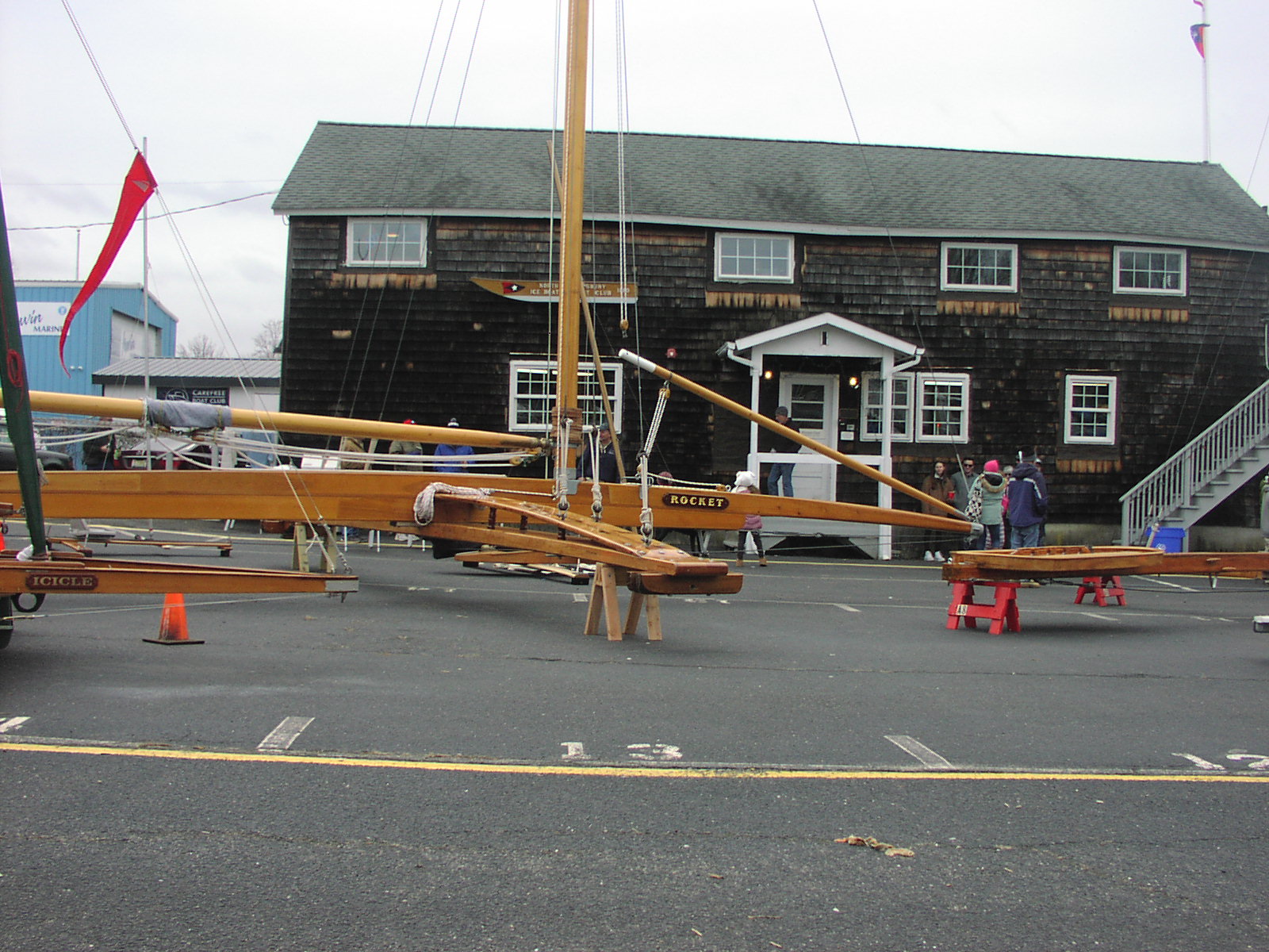
Ice Yacht
ROCKET at NSIBYC Club House on "John Holian
Day"
FDR Wallace
Center Ice Yacht Display
I met people
from as far away as Maine, Michigan, and Virginia at the
recent show -- lots of interest in the history of ice
yachting and FDR's involvement.
Three historic
Hudson River Ice Yachts will be on display in the Wallace
Center at the Franklin D. Roosevelt Presidential Library and
Museum.
Hound, Allons,
and Comet were all sailed locally in the Poughkeepsie and
Hyde Park fleet.
These restored
yachts were built and sailed in the Hudson Valley around
1900 and are still actively sailed by members of the Hudson
River Ice Yacht Club.
FDR, who was a
member of the club. owned HAWK, a gift from his
mother. HAWK survives in the museum collection and is
occasionally displayed.
The free
exhibit will be open to the general public from December 23,
2024 to January 5, 2025.
The holiday
weeks are very popular at the Library with many visitors
attending from home and abroad.
https://www.fdrlibrary.org/fdr-and-ice-yachts
https://www.fdrlibrary.org/events-calendar
Hudson
River Ice Yacht Preservation Trust
First
Anniversary Celebration January 3, 2025 4 - 6 pm
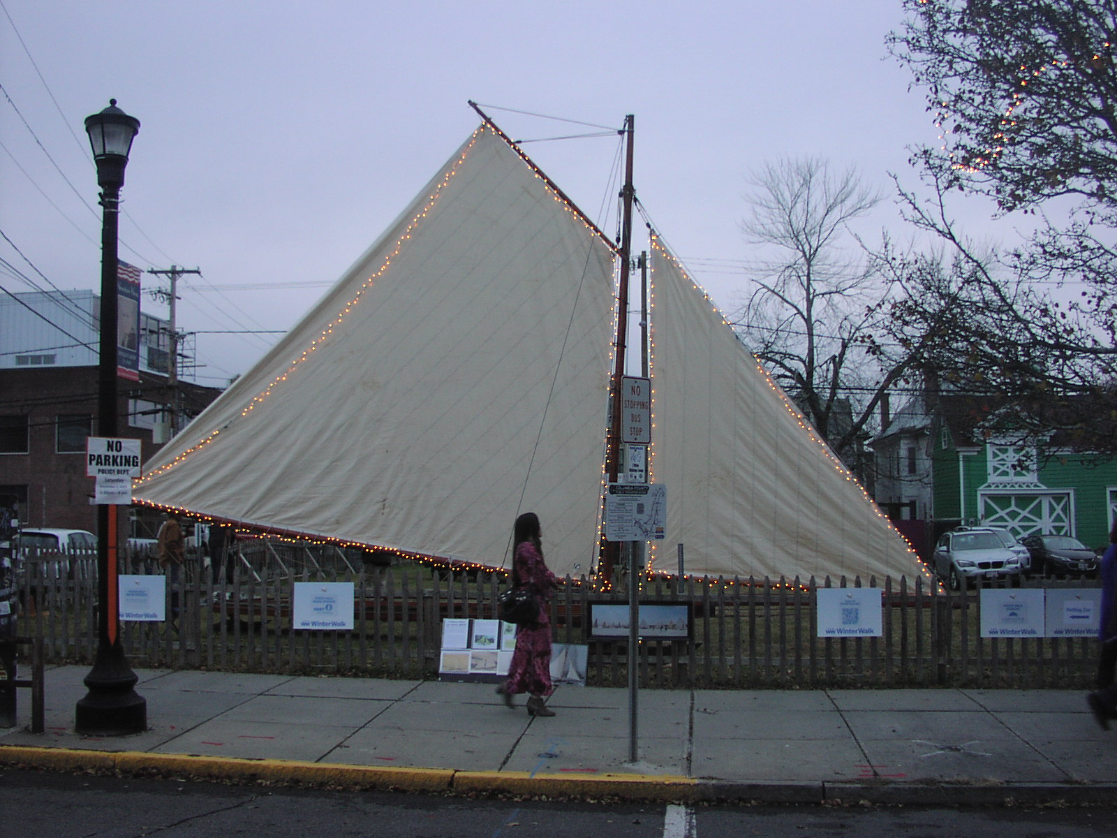
White Wings and Black Ice
Historic stern
steering ice yacht Galatea
setup for today's City of Hudson annual
"Winter Walk" street festival
The Wreck of the Galatea -- More on the Trials and
Tribulations of the Restoration of Galatea

James Bay Vortex, "Clipper" Type Shortwaves Bring Snow
Squalls And Warm West Vs. Cold East Pattern
-----------------------------------------------------------------------
Notice from
Brian Reid -- Secretary of the Hudson River Ice Yacht Club
Hudson River Ice Yacht Club Annual Meeting
Kingston Home Port
44 Rondout Landing
Kingston NY 12401
Sunday, December 8, 2024
1:30 - 4:30 pm
Join us for our Annual Meeting & Gourmet Pot Luck Luncheon
Friends, Guests, and New Members Welcome
Club dues ($25) are due*. Bring a dish** to share
and your favorite beverage.
|
* Natalie Gilbert -
Treasurer
hudson river ice yacht club
76 Tivoli Gardens
Tivoli NY 12583-5427
|
Hudson Winter Walk
Reid Bielenberg plans to set up the
historic ice yacht Galatea in front of the
Back Bar
at 347 Warren Street, Hudson NY. Help is needed Friday
afternoon December 6th and on
the day of the festival, December 7, 2024. Contact Reid if
you can assist in setup or manning the exhibit.
The following Saturday, December 14, 2024,
it will be Athens' turn to host a display of the ice yacht
Sappho
at Riverfront Park on Water Street. The Victorian
Stroll event is an all afternoon affair.
The opening ceremony is 1 pm at the
Athens Cultural
Center --
24 Second Street.
Again, help is needed and welcomed to
mount these exhibits.
Sappho -- a heavy old beast of the early
siderail design
"When the
average daily temperature goes above 20°
F, we are losing ice on the Hudson River"
Nice 2022 Athens photos here at this
post of Peggy Huckel’s
Vixen and Whiff sailing on
the Hudson River 2005
MP4 Video thanks to Bob Wills
Glenn Wheeler Drone -- YouTube Video from
Athens
Where are the Ice Breakers? Control Click to
open in a new tab.
Penobscot Bay
Sturgeon Bay
|
WHIFF at Hudson
Winter Walk 2023
Once again, the Hudson
River Ice Yacht Club was invited to display one of our
historic ice yachts at the annual Hudson Winter Walk street
festival. This year we chose Commodore Irving Grinnell's
1875 yacht
WHIFF which has been in the club's possession for many
years. Grinnell had this yacht built specifically for
display at the Philadelphia Centennial Exposition of 1876
representing the state of the art in ice yacht development
and construction. Master builder Jacob Buckhout was given
free reign and a generous budget to create a most elegant
and modern yacht. Nickel plated hardware, gold leaf trim
accents, two carved griffins, and a suit of Egyptian Cotton
sails graced the hall at the grand opening.
Not all of that luxury has
survived to this day, but the basics are still in place and
the yacht looks as smart and handsome as ever. Several
hundred visitors looked on in awe when they learned the
elegant yacht first sailed in 1876 is still an active member
of our fleet today.
Sacandaga Reservoir 2023
Roundup
Determined to get in a bit
of sailing this winter, there will be an expedition to
Sacandaga Reservoir this weekend. People will begin arriving
at the
Broadalbin Public Boat Launch noon Friday to inspect the
ice and assess the conditions. There is no guarantee there
will be good sailing, but last weekend's subzero weather
built enough ice to encourage people load up their boats and
hit the road.
It will be very windy
Friday and Saturday with gusts 40 - 50 mph -- bring your
storm sails. A small heavy jib, might suffice those two
days.
Broadalbin Weather Forecast
From the
Saratoga ice sailing facebook group:
"
Just did a quick scout of Sacandaga at Broadalbin launch.
Drilled 7”+ before drill died. Local reports say 10”+. Snow
on surface now water. All we need now is cold temps. Those
won’t arrive until Friday night (mid 20’s predicted). I’m
thinking this has good potential for Saturday. Could sail it
tomorrow but I think it will be puddly, and gusts over 40mph
predicted. As always be very careful on this body of water
due to it being a reservoir with constantly changing levels
and frequent pressure ridges.  carefully Scout and drill
everywhere before taking high speed runs."
Arctic Blast is History
We Begin a Warm and Wet
Week
Sunday, February 5, 2023
The coldest air mass of
this winter and the coldest since 2016 made a brief visit
Friday afternoon through Saturday afternoon. My thermometer
here at Beckwith Hill bottomed out at -7 F early Saturday
Morning, recovered to near 10 F by 5pm and continued
climbing to 20 F at midnight. Some shallow ponds that had a
bit of a icy surface coating made two inches of new ice
during this period, but the Hudson River has nothing but a
bit of thin brash surface ice freely floating with the tide
at this hour. Most of this will mix out and melt as
temperatures go back to 40 F for most of the week. Runoff
and surface stream flow will resume again tomorrow. Absent a
10 day Arctic outbreak similar to what happened in 1978 from
February 9 - 19th, I think it is fair to speculate that we
will likely be skunked this year. Summer may be cooler than
last year (more like a "normal" year) according to some
pundits, which would be a welcome change -- the current
setup could be the prologue of a banner spring for 3 - 4
powerful Nor'easter's come March, April, and early May.
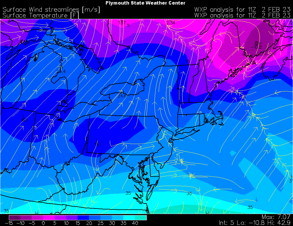
Arctic Cold in Downeast
Maine
Thursday, February 2,
2023
The coldest air is just
east of us in Newfoundland. Here in the Hudson Valley the
wind is out of the south and temperatures have remained in
the 20's for the past two nights. Some of the shallow ponds
have formed a bit of ice, but we need temperatures of 10 F
or lower to make some real thickness. The core of the jet
stream is directly overhead running from Arizona to Maine
pulling in warmer air aloft and fending off the Polar Arctic
air mass to our north. Flights from Los Angeles to New York
were getting a 150 mph boost in their ground speed
yesterday. I ran BUFKIT this morning and the models are
still showing a Friday to Saturday blast of near zero degree
temperatures for Poughkeepsie, but looking at the maps
visually, it looks like the coldest air is sliding east and
retreating north and may miss us.
Still No Sailing in
Sight
Hopes for an Early
February
Freeze Seem to be Fading
January 29, 2023
The week started out with
nuisance snow and rain followed by a cold night which
slicked up area driveways. Warm and sunny weather followed
and melted most of the snow by mid-week -- tonight a modest
drop in temperature will follow the passage of a weak cold
front, but overall, temperatures will remain above the
seasonal average until the end of the week at which time
frigid arctic air may bleed across the Niagara and St.
Lawrence rivers into northern New England and build a few
inches of ice. The large lakes such as Winnipesaukee in NH
and Sebago ME are practically ice free and may barely close
by the weekend before the warm air from the southwest scours
out the cold air again and the lakes return to open water.
Should this come to pass, we will probably be skunked again
this season.
Quoting the National
Weather Service:
"As mentioned, the ensembles and global guidance are in agreement
that the cold outbreak is short-lived with temperatures returning
back to normal by Sunday and the start of the new work week."
And Larry Cosgrove:
"Analog and numerical model forecasts for March are mostly in the mild
or warm category, so the clock is running if you want a more typical winter
setting to arrive."
March could be wild with the clash of air masses spawning thunderstorms, tornados,
and powerful nor'easters east of the Rockies.
No
Sailing in Sight
January 22, 2023
High pressure off the
Delmarva Coast will squeeze a weak low pressure system
inland of the coast until it arcs east through Long Island
into the Atlantic. A mix of rain and snow will develop late
this afternoon and early evening across the Northeastern US.
Valley locations should see mostly rain and little snow
accumulations while snow, perhaps as much as 8 inches, will
fall in the higher elevations to our south and west and
across much of New England.
Temperatures should fall
to near normal levels by midweek as another stronger storm
moves across the country from New Mexico to the Tennessee
Valley and into the St. Lawrence Valley. If the current
forecast track holds, we should see rain here in the Valley
from this storm as well.
Some forecasters see the
potential for an arctic outbreak the last week of February,
but with no ice in place, winter winding down, and the
general global pattern of the cold air sitting on the pole
all winter, I think we would be hard pressed to get anything
more than a smattering of ice that will rapidly disappear.
We would need a ten day deep freeze of zero degree nights to
generate some short lived sailing. In 1978, we had such a
freeze from Feb 9 - 19th and there has been late ice many
years -- but making 8" of ice for the big boats from nothing
is hard to do after Valentine's Day in this era of global
warming.
January 16, 2023
While the West Coast is
getting battered with round after round of wind, snow, and
rain storms, the East remains relatively tranquil and warm
for January. The large nearly stationary low that developed
off the Delmarva Coast last weekend is slowly weakening, but
still managed to create strong winds with areas of snow,
sleet, and freezing rain from Cape Cod to Downeast Maine
last night. A bit of light snow even made it west into the
Taconics, Berkshire Hills, and Green Mountains for a few
brief hours.
The sub-zero air mass is
steadily shrinking and retreating toward Greenland this week
-- the long range numerical models show little change from
last week -- the cold air sits well to our north and once a
week burps a weak pulse our way across the Canadian border.
I see no real reason for this to change in the next two
weeks -- once we are into February it could be a quick slide
into a train of wet snow and warm sunny days where our
sailing prospects become nil.
In the Northeast in late
February and early March, a number of factors come together
that cause the direct normal intensity of the daily Solar
radiation to reach its annual maximum of about 10% above the
average value of 1000 Watts per square meter. People who are
outdoors all day in the winter often have a gentle suntan by
late February or early March. If you are sitting outdoors in
a chair watching the birds at the feeder or if you are
charting the output of your rooftop solar system, the bump
in output is very noticeable.
5
x 5
5 Subjects as Seen
by 5 Photographers
Morton Memorial Library
82 Kelly Street
Rhinecliff, NY 12574
Saturday January 7, 2023
4:30 - 7:00 pm

-----------------------------------------------
Announcing Hard Water Sailing:
The Ice Boats of the Hudson River
A Solo Exhibition of Photography by
Adam T.
Deen
The Stewart House
Athens, New York
The Exhibition Showcases the Hudson River
Ice Yacht Club
Opening: Sunday, January 8, 2023 3 - 6 pm
Exhibition: Jan 8 - Mar 31, 2023 (Closed for
February)
January 2023 Weather Outlook
As the new year begins, we are in a
tranquil and warm pattern. NOAA's
Climate Prediction Center outlook for the January -
March 2023 period concludes:
"Positive Sea Surface Temperature
anomalies persist over the Gulf of Mexico and along the East
Coast with the largest anomalies offshore of the
Mid-Atlantic and New England."
While some see analogues to the cold winter
of 1994 which gave us good ice and sailing on the Hudson
River from Verbank to Hudson, this seems unlikely to me
given the current trends. The first two storms of the winter
resulted in what I consider to be "busted forecasts" -- the
phasing of the low pressure systems off the Atlantic Coast
that the models predicted, did not occur. Last weekend's
epic storm in Buffalo was the result of the low pressure
center developing north of New York State in Canada
resulting in rain and warm weather wrapping into the system
east of the Catskill Mountains to the Atlantic Coast, and
very cold air being funneled across the Great Lakes
triggering copious amounts of Lake Effect Snowfall. While
two cold nights did bring the Hudson River down to freezing
early in the week, by Thursday it was 60 F in Poughkeepsie
once again as the cold air retreated to areas north and
northwest of Hudson Bay. At
North Germantown Landing, what was free flowing ice on
Tuesday is once again entirely blue water. Northern Maine
may make a bit of ice during the long nights of the coming
week.
Looking Ahead -- Animated Global Data Modeled
Click and hold on the globe and rotate the view to North
America.
Click on "Anim" to put it in motion or hover over the list
of hourly forecast times to step through the model
output.
Note in the forecast graphics that the dominant circulation
remains a zonal pattern west to east across the central and
eastern USA with occasional weak pulses of cold arctic air
barely crossing the Canada - USA border.
The cold air can sit on the poles all winter if there is no
general circulation moving it to the lower latitudes. It
looks to me like we are in for a warm winter into at least
mid February if you believe the forecast modeling.
In my view, the forecast models have not done very well the
last two weeks, so I tend to ignore everything beyond five
days out. Larry Cosgrove publishes his updates about noon on
Saturday's -- we'll get his take shortly.
End of the 2022 Season Recap
With a second winter of
the COVID Pandemic, we tried to maintain a low profile of
our on ice activities -- but that's hard to do in this era
of social media and universal Internet access. Within an
hour of arrival to set up at Murderer's Creek, word was out,
and during the next two days there were several hundred
visitors to the ice. There was more pushing, than sailing,
but people enjoyed the scene and seemed happy to be out of
the house and participating in the small gathering of these
old ice yachts that were built in the 1880 - 1910 era of our
history.
The winter was marked by
less than average precipitation and one deep freeze period
of January 21 - 31, 2022.
Contrast this to the last
time we had very good ice boating on the Hudson River. In
2014, we had three deep freezes -- Jan 21 - 30, Feb 3 - 13,
and Feb 25 - Mar 6th -- and a 21 inch snowfall on Feb 14th.
The snow fell and saturated on the river between the deep
freezes and build a nice thick layer of snow ice on top of
the stronger brash ice below. The NSIBYC restored 50' Ice
Yacht
ROCKET was trailered up, assembled, and made its first
sail in 100 years.
While we were hopeful for
some sailing off Cheviot or Barrytown this year, it's clear
why that did not happen and why the river ice broke up so
quickly.
Friday, February 11,
2022 -- End of the Season
Murderer's Creek opened up
this afternoon and one person went through the ice --
fortunately in shallow water up to his chest -- and was
immediately retrieved with no ill effects.
A strong south wind, abundant sunshine, and 50° F
temperatures rapidly eroded the ice in Athens today.
More of the same is expected tomorrow. Two boats have been
removed, and the rest of the fleet will be off the ice by
this evening or tomorrow morning.
Sorry, but that's the way it goes in this sport -- maybe
next year.
|
Current Jetstream Forecast and Surface Conditions -- Image by
Environment Canada
Radar Picture of the Superstorm of March 13, 1993 -- 32" of
snow in Rhinebeck NY

20 Radar Road Sedgwick Maine -- Sunrise over the Mountains
of Acadia National Park |
|
|
|
|